31-60

Day -56: Champaign, IL

Good morning, afternoon, or evening, wherever you are!

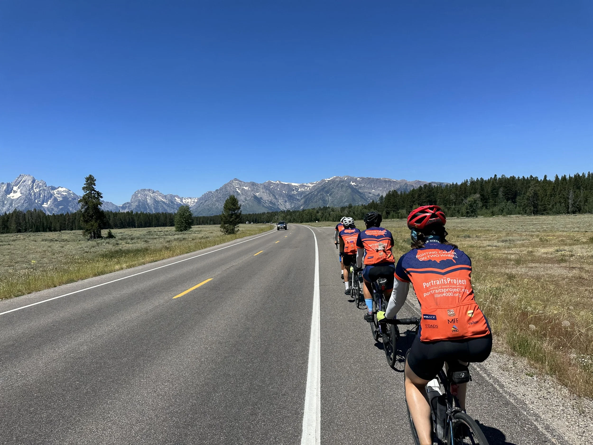
Today marks the -56th day until we fly out of Chicago to begin our Illini 4000 cross-country ride! My name is Jonathan Boudreaux and I will be your journalist for the coming summer! :) Our excitement is ramping up as we complete our pre-ride fundraising goals, begin our longer training rides, and continue to count down the days. Tonight, we are staying in, you guessed it, beautiful Champaign, Illinois! Today and tomorrow were supposed to consist of an overnight training ride, but due to some uncooperative weather, we have rescheduled the majority of the ride to Sunday. What this doesn’t stop us form doing is training for our chores at a local church.

Chores are the various tasks that are needed and completed throughout the ride; they range from duties such as packing the van, making breakfast and dinner, and waking everyone up (truly a selfless and necessary task), to repairing bikes, managing our funds, and running our social media accounts (@illini4000, go like and follow!). We are also getting our first taste of I4K spaghetti, which will be a common dinner for us throughout the summer.

I am currently sitting in front of a riveting chess match between Paul and Adam as we eat and get ready to head out before the thunderstorms arrive. We will ride 50 miles beginning Sunday morning at 7 AM sharp, followed by a 70 miler and two 90 milers in the coming weeks. We will see you again on May 26th for our flight to NYC and the beginning of our journey! :)

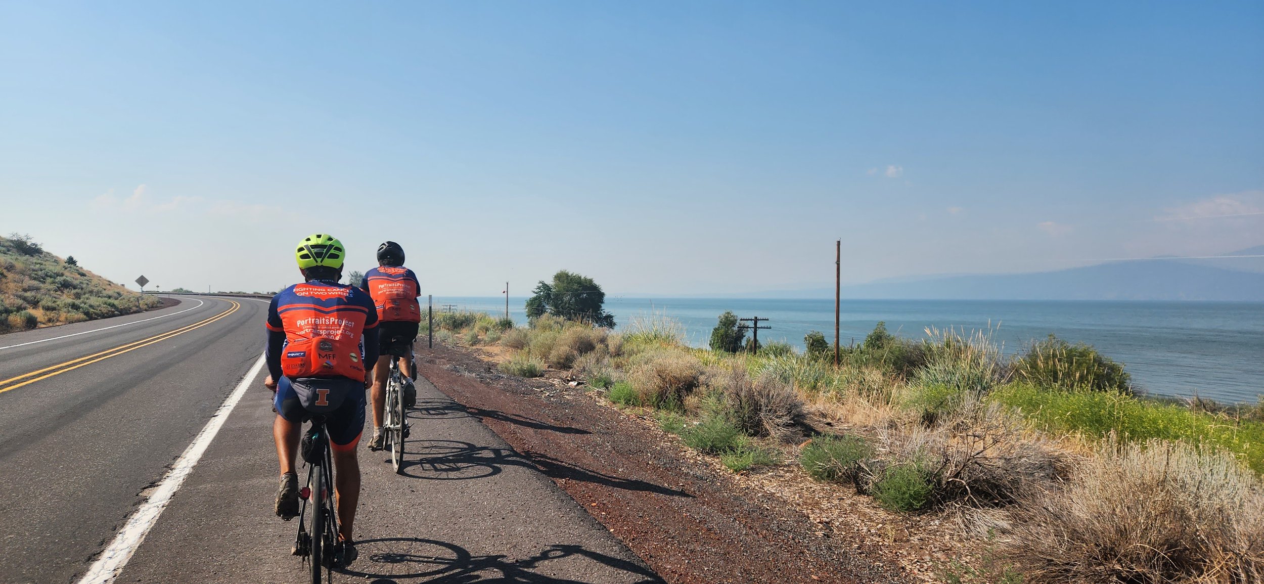
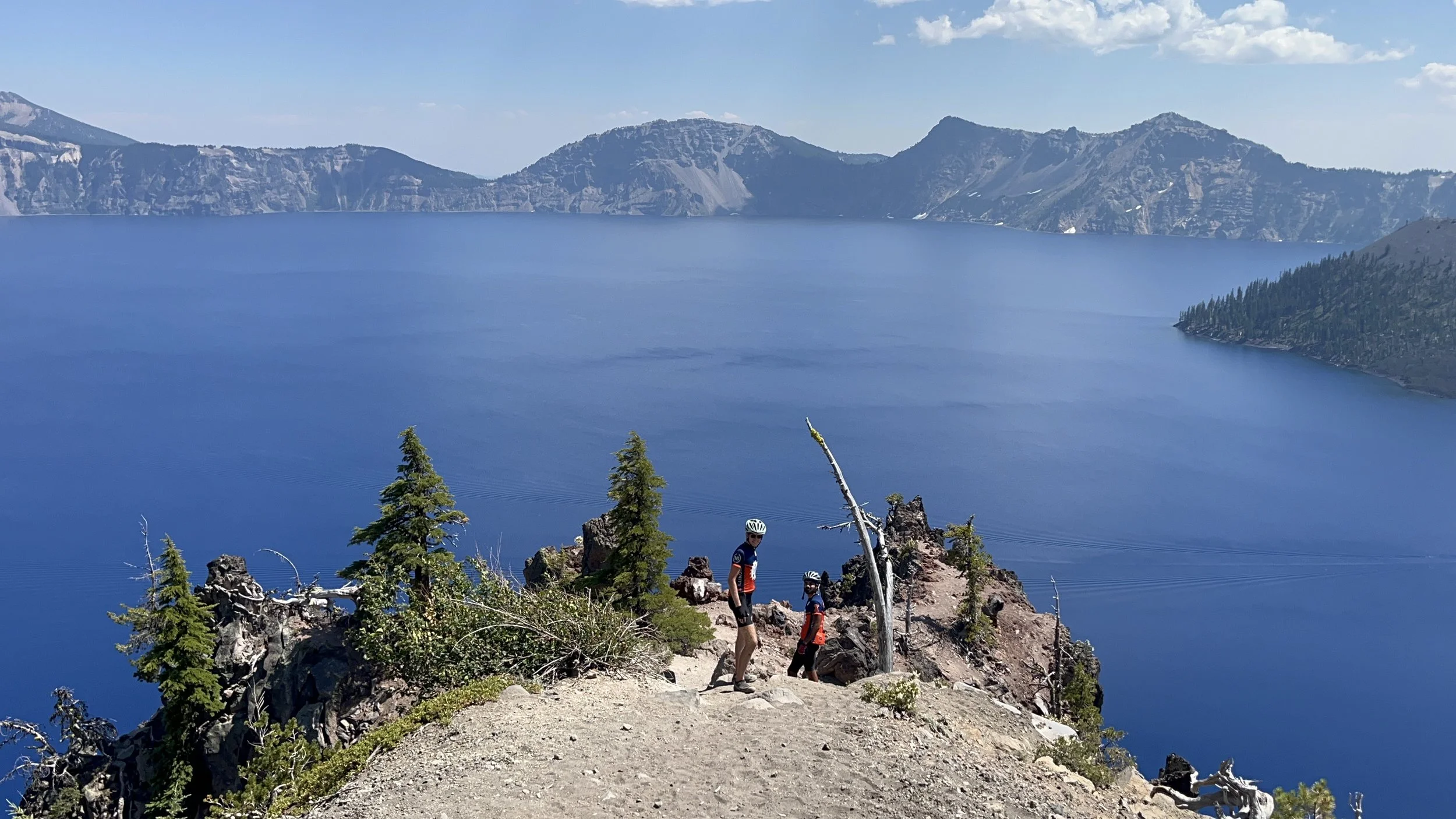
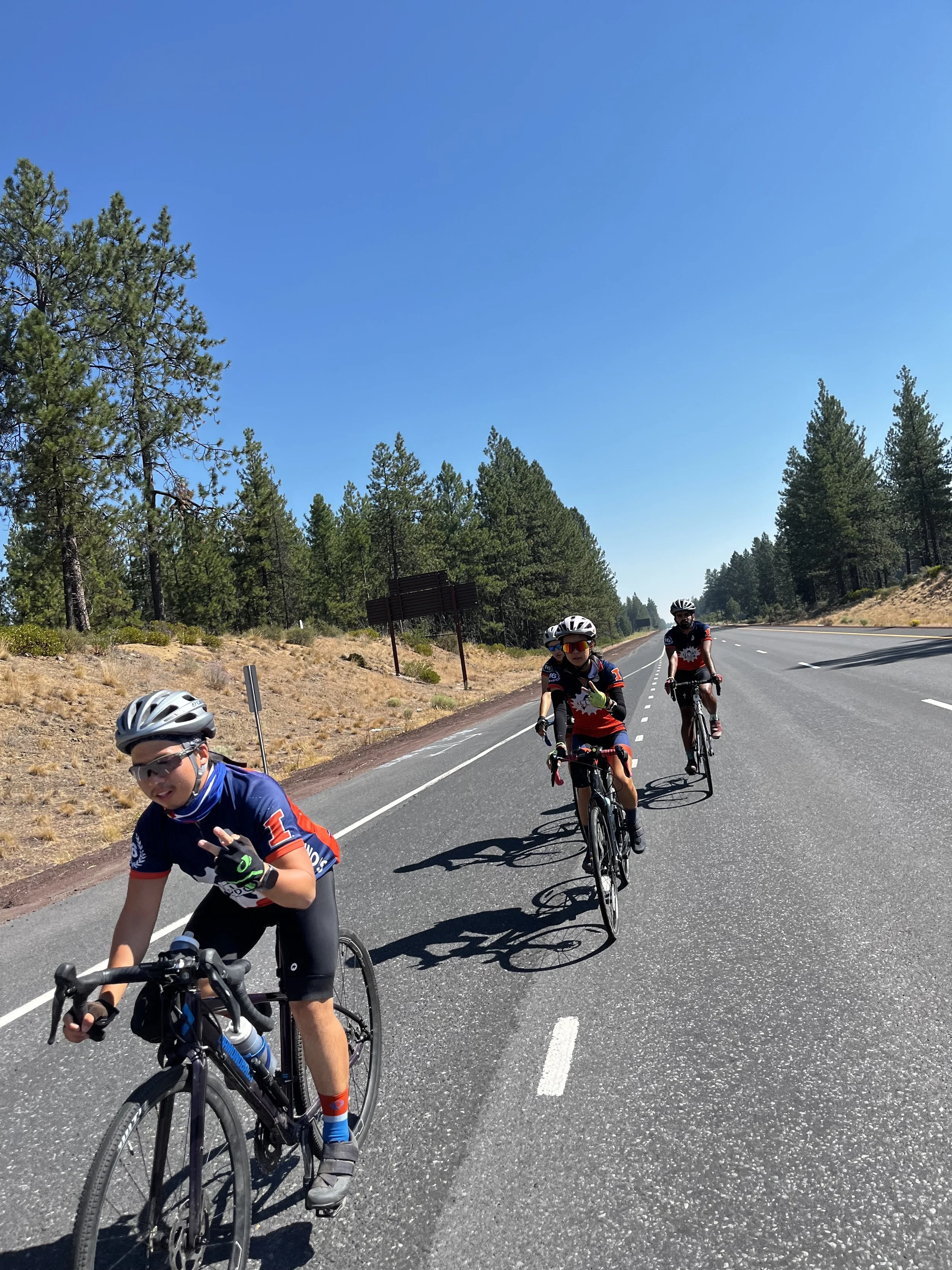
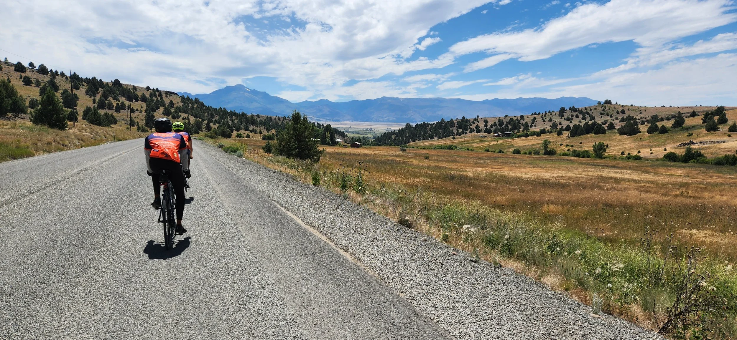
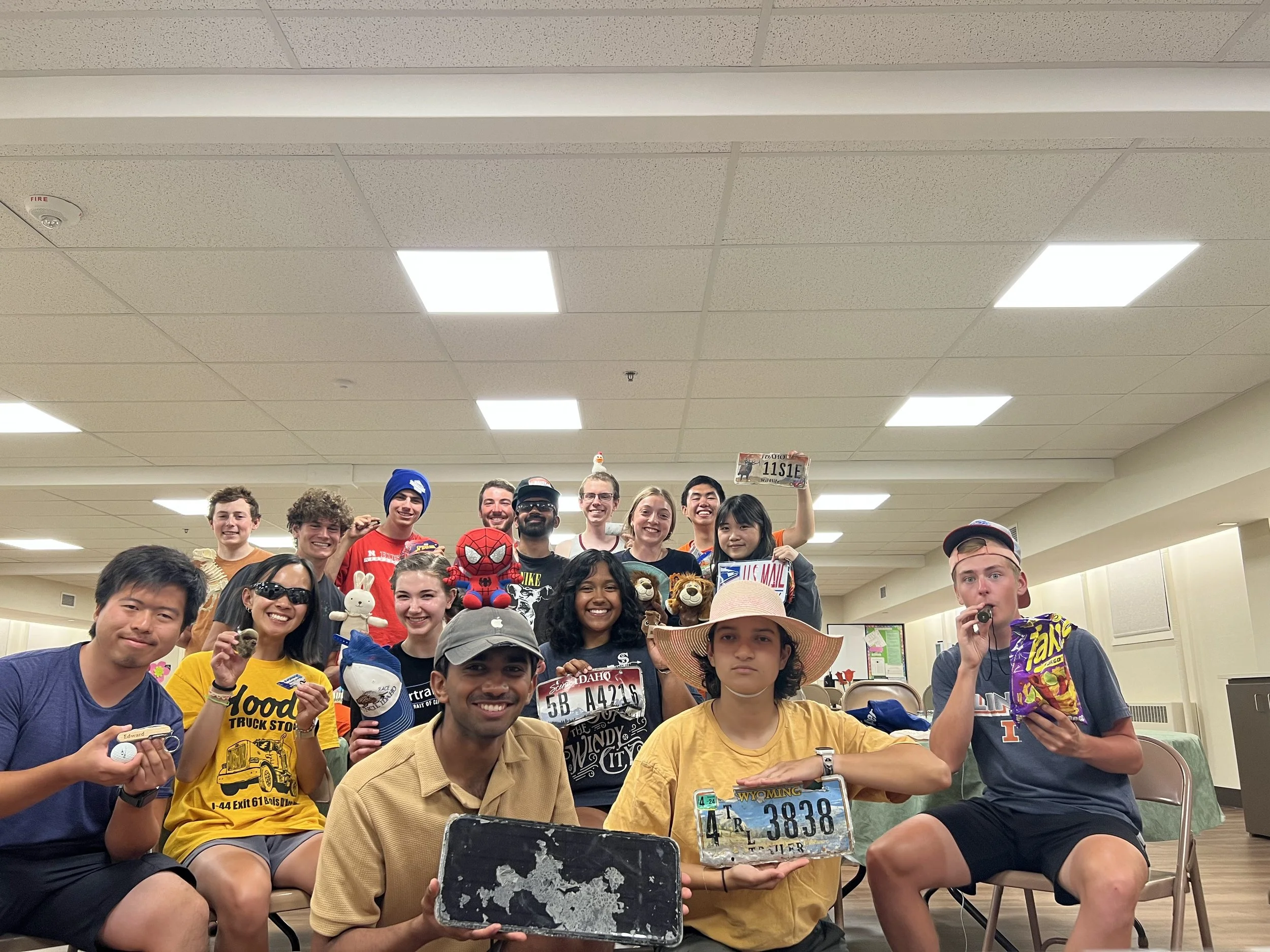
Pictured L to R: Adam, Hanna, Nabeel, Sam M., Paul, Sam R., Jonathan

Days 68 & 69: One Last Rest Day. Crater Lake N.P. to Klamath Falls + Rest Day

A chance to rest and recuperate at the end of our time in our penultimate state, Klamath Falls gave us a chance to prepare for the absolute gauntlet that biking through half of California will be during the coming week. Now that we are in the final ten days of the ride, we are fully immersed in the very emotional reminiscence of all that it took to get ourselves this far as a team and as individuals. With this in mind, enjoy a bonus pre-ride journal entry after you finish reading this one. :)

A few riders took the van to the rim of Crater Lake for a sunrise that can’t be beat.

Ride Overview

Mileage: 54.6

Elevation: +863’/-2669’

General Direction: Exit the campground onto southbound Crater Lake Highway (OR 62), continue for 30.3 miles until making a right onto southbound U.S. 97, at mile 51.1 keep left onto the business loop, turn left after three miles onto Washburn Way and climb the hill to reach the stayover.

Points of Interest: Cascade Mountain Range (Union Peak, Sky Lakes Wilderness, Aspen Butte), Upper Klamath Lake, Williamson River

The western view for much of the second half. Mountains are obscured by the haze from smoke in the atmosphere.

Tales of the Trail

Ten miles of descent off the smooth yet pined backside of Mount Mazama and its sister mountains started our day off with a bang. Jackets were worn by all to brace for the chilly mountain winds as light continued to fill the sky and pierce between the trees. This boost in mileage offered us a sense of silent optimism for the day that lasted for the rest of the route, even when things got a little hairy in the second half. We continued to make our way along the eastern mountain ridge with flats to our right full of blissful emptiness and grazing cattle. Taking apart the silence at the beginning, mile 30 brought us back onto U.S. 97, and an extremely wide Upper Klamath Lake appeared on our right as the highway began to squeeze itself between it and some imposing rocky hills. Cars and trucks thundered by as we were confined to a pretty gnarly shoulder, and the lake looked more like a sea as wildfire smoke created a haze that covered the mountains to the north and west. A few bald eagles as well as ospreys and other birds of prey delighted us as they flew along the edge of the water. Entering town from the north, we continued onto the business spur for a few miles and, as is tradition, climbed one last hill to our stayover. For our efforts and early arrival, we got lunch in groups in downtown Klamath Falls.

Finishing van packing for the day.

JY and Adam pedaling along Upper Klamath Lake.

Kathryn’s group among some Oregon conifers.

We are staying at the United Evangelical Free Church where we have been given a kitchen, showers, and lots of space to spread out and sleep (including a room of couches!). We gave ourselves the opportunity to settle down and rest up for this final and important rest day.

First San Francisco sign!

Some actually incredible Thai iced teas to start the rest day cycle off right.

Absolutely enthralled by our dinner of chili and veggies by Chef Hanna.

The Rest Day

Klamath Falls gave us much to do for being on the smaller side of towns we’ve had rest days in. We split into groups for lunch and ran a few errands including some post office runs, shopping for prom clothes, and bike repairs. Many stayed at the church and slept or ran some laundry and took care of other necessities. For dinner, we dined at the, er, interesting Red Rooster, which while not entirely notable food-wise gave us the chance to start to reminisce as an entire team; truly a wonderful time as well as a sign of the end being in sight.

Chilling in the main room of the church.

A top five sunset to end off the last rest day.

Cyclist’s Corner: Team Edition

From now until the end of the ride, this segment will be a single open answer or poll-style question that most or all of the team will answer. :)

Today’s Question: Where was your favorite stayover? (Written by order of appearance on route.)

River Forest, IL: Sam R

Lincoln, NE: Nina

McCook, NE: Sam M

Boulder, CO: Jaylen, Jonathan B, Jean, Kathryn, Adam, Laurel

Frisco, CO: Jonathan Y

Big Piney, WY: Patrick

Jackson, WY: Edward

Arco, ID: Paul

Boise, ID: Nabeel

Ochoco Temporary Stayover (Hwy 26): Hanna

Bend, OR: Olivia

Rest day shenanigans. :)

Day 67: Crater Lake. La Pine to Crater Lake N.P.

Crater Lake, situated in south-central Oregon inside the collapsed crater of Mount Mazama, has a surface area of 20.6 square miles, a maximum depth of 1949 feet making it the deepest body of freshwater in the United States, and its water can be described as only the most brilliant shades of blue. Every pedalstroke of the climb leading to the crater’s edge was worth it to take in every bit of this deceptively wide and sparkling lake, its massive cliffs, and its surrounding mountain ranges. Truly a place worth visiting at least once in one’s life.

Does this one look familiar?

Ride Overview

Mileage: 87.4

Elevation: +4565’/-2788’

General Direction: Navigate east through La Pine and turn right onto southbound U.S. 97, ride for 62.6 miles, turn right onto OR 138 and, 15.1 miles later, follow signs for Crater Lake to turn left onto Rim Drive, follow by the western edge of the lake and ride until reaching the campground on the left.

Points of Interest: Gilchrist State Forest, Cascade Mountain Range, Mount Thielsen, Umpqua National Forest, Crater Lake National Park (Crater Lake, Wizard Island, Llao Rock, Hillman Peak, Garfield Peak, Mount Scott, etc.).

Tales of the Trail

We began our day with a 51-mile stretch on southbound U.S. 97, mostly uneventful except that the temperature jumped over 30 degrees and Cascade peaks passed us by ever so slowly on our right. Our right turn at the end of this took us toward Mount Mazama and into Crater Lake National Park. From here, the signature six-mile climb toward the rim of the lake began. Pines old, young, and dead from wildfires passed us by, and more mountains and volcanos began to appear the higher we climbed, some near and some quite far. Sharing the westbound Rim Drive with cars was a bit stressful, but we made it all the way up with no issues. It was worth every second. The final steps up to the edge of the canyon brought the lake as a whole into view, and it stunned us from the beginning. Wizard Island, one of the emergent volcanic cones and quite tall in its own right, looked like a small foothill from how high up we were. Rock formations and surrounding peaks dotted with all sorts of plants and pine trees brought a lot of character to the place. We stopped to take it all in and take some team pictures, then continued riding into the evening and down the descent to our campground at Mazama Village. It was a day none of us will soon forget. I’ll let a few pictures do most of the talking.

Adam, Jean, Olivia, and Jon Y entering the park. Groups had to shuttle through the gate in the van.

Patty, Hanna, and Nina on 97.

Squirrel <3 Snowman

Making the final ascent toward the rim.

New pfp for Jaylen. :)

JB and Nabeel making their way to the overlook upon reaching the west rim.

Taking it all in.

Paul went on an intense and meaningful solo ride following his time driving the van and captured an incredible sunset.

Cyclist’s Corner: Team Edition

From now until the end of the ride, this segment will be a single open answer or poll-style question that most or all of the team will answer. :)

Today’s Question: Does your bike have a name? If so, what is it?

Paul: Ol’ Red

Patrick: Roxanne

Nina: Billy Jr.

Sam R: Blue(s) Traveler

Jaylen: Best Gear Program Bike

Jonathan B: Bichael, or Bike for short

Jean: Pink Traveler

Ed: Twilight Shredder

Sam M: White Mamba

Kathryn: I rode from coast to coast on a bike with no name. *tumbleweed emoji*

Nabeel: Sike

Olivia: Sally

Adam: None

Laurel: Bichael

Hanna: Chip

Another angle of the iconic team photo.

Selfie from the B reel featuring the classic Ed salute.

Day 66: Cascade Cruise. Bend to La Pine

A short n’ sweet entry for a short n’ sweet ride which became another rest day in Bend mostly. :)

View from the top of Lava Butte.

Ride Overview

Mileage: 33.0

Elevation: +1205’/-650’

General Direction: Proceed south through Bend and use Murphy, Parrell, China Hat, and Knott Roads to reach southbound U.S. 97 at mile 6.7, continue until mile 16.4 and exit onto South Century Drive for 9.0 miles, turn right onto State Park Road at mile 25.7, left onto 5th Street and right onto Amber Lane to reach the stayover.

Points of Interest: Cascade Mountain Range, Lava Butte, La Pine State Park

Jon Y and Jaylen enjoying dinner at Wild Rose.

Tales of the Trail

A late wake-up and an early morning game of People Pong using blueberries put us in good spirits to tackle this easier 33-miler. Carving through the wooded, volcanic ground, the route was easy to follow and required only one rest stop. Three riders, Paul, Sam R, and Adam, climbed the Lava Butte bordering U.S. 97 and got some tremendous views of the Cascades. We arrived in La Pine around 1:00 PM to High Lakes Christian Church. After taking showers at the Senior Activities Center, we drove the distance we had just biked in about thirty minutes to spend time as a team in Bend. Another Costco run garnered us some camping food, and groups spent time eating dinner and exploring the downtown Bend area. To end off the day, a beautiful sunset could be seen from the van falling over the Cascades, and behind them but unseen, the Pacific Ocean.

People Pong ft. Costco blueberries.

Sam R climbing the side of the butte.

Sam R, Adam, and Paul at the top of the Lava Butte.

The only rest stop - note the group attempting to put Hanna’s stubborn tire back on after a flat.

Jaylen, Jon Y, Nina, and Hanna hanging out in Bend. Hanna and Jaylen cashed in on their pickleball win in Big Piney, and Nina and Jon Y bought them all dinner.

Day 65: The Race to the Last Blockbuster. Ochoco National Forest to Bend

What we do requires high physical, high mental, and high emotional input. It means something to those we talk to, to those who hear about us, those we hold closest, and those we will never meet. It means so much to us both as a team and as individuals. The malicious entity that is cancer, so intrinsic to our own bodies that it is literally our own genetic material malfunctioning, affects so many people in so many awful ways. Today, we completed two incredibly powerful Portraits. The stories of Hilary and Marion, the former a deacon and the latter a parishioner at the First Presbyterian Church of Bend, truly and deeply impacted all of us. We work to make sure they, and as many as we are able to talk to, have their stories shared with each other and the world. That is why we are here in Oregon now, why we were in Utah twenty days ago, Iowa forty days ago, and all the way back in Pennsylvania sixty days ago. That is why this is the sixteenth of these cross-country rides.

Ride Overview

Mileage: 66.1

Elevation: +1897’/-2926’

General Direction: For the first 31.8 miles, follow westbound U.S. 26, exit onto OR 126 and follow for 11.2 miles, turn left onto Southwest Powell Butte Highway and stay on until reaching Bend Municipal Airport, turn right onto Butler Market Road, take five roundabouts within town to stay on the road until exiting onto 8th Avenue for the fifth (same direction), continue south to reach the stayover on the left. Optional: Use Seward Ave. to reach the Blockbuster, then continue south on 2nd Avenue and east on Greenwood Avenue to reach 8th Avenue.

Points of Interest: Ochoco National Forest, Ochoco Mountain Range, Ochoco Reservoir, Crooked River, Oregon Badlands Wilderness, Cascade Mountain Range (North Sister, South Sister, Broken Top), Pilot Butte, Last Blockbuster

Tales of the Trail

The campground sits at the top of the Ochoco Pass, which means it was a chilly start to the day. We tore down camp and found ourselves descending from the start as the trees whipped by and the sky continued to brighten. We completed the first 30 miles of the day in just over an hour, and found ourselves at a place called Tastee Treet in the town of Prineville. So, naturally, this became our breakfast stop, and we had omelettes and shakes and breakfast skillets galore. After this, a brief but steep climb out of the river valley gave us a pleasant final look at Ochoco to our left, and from here we continued following some busy two-lane highways with narrow shoulders through farmland and along some pine flats. At our right turn into what would be the main road we would take into Bend, we witnessed the majesty of some of the most beautiful mountains we’ve ever seen - the Three Sisters within the Cascade Range, appearing quite prominent for 30 miles away.

What we woke up to.

Tree shadows overtake the road out of camp.

Nina, Patrick, Smokey, Smokey, and Paul promoting wildfire prevention.

With the help of five somewhat stressful roundabouts, neighborhoods and businesses began to appear and we found ourselves in the city of Bend. Of course, no stop here would be complete without a visit to the last operational Blockbuster in the world, so much so that our planned route diverted from the main road to meet it. A few more turns through the business district brought us to our destination: the First Presbyterian Church of Bend.

The Last Blockbuster.

After some showers at the local recreation center, we retreated to the stayover for a wonderful dinner of lasagna, salad, and a mountain of homemade cookies organized by Hilary and Marion. Folks in the church community were quite welcoming and we conversed with Hilary, Marion, and a few others during dinner. From here, the team split into two halves and we created some immensely moving Portraits of both Hilary and Marion, the former a cancer patient and the latter a cancer survivor. Their stories were some of the most simultaneously difficult and beautiful we have listened to thus far, and I encourage everyone reading this to view all of our Portraits when they are published including theirs. After the Portraits were concluded, a few of us went on our first I4K Costco run with 30 minutes to spare before the store closed! Tomorrow is an easier day of 33 miles into the town of La Pine, and wakeup was pushed back to accommodate for this.

Plundering the Costco with minutes to spare.

Successful Costco run with Patty, Nina, Nabeel, Edward, JB, and Hanna.

Sunset over the Deschutes River.

~Dictionary of I4K~

Special Edition: A Guide to Common Callouts

Slowing: Coasting, braking, or otherwise reducing speed. Most common callout used.

Fall In/Falling In: Group condenses into a pace line and follows directly behind first position.

Take the Lane/Taking the Lane: Moving to occupy the width of the right lane. Used before stops and on four-lane roads. Done before moving to inner lanes for a left turn. Means of making sure cars pass safely and notice riders easier.

Car Back: Vehicle behind the group in occupied lane or lane next to the shoulder. “Truck” or other vehicle type may replace “car”, and other directions are used to indicate vehicle position (car up, car right).

Passing: Vehicle passing on the left. “Passing right” used if vehicle passing on the right.

Clear in the Rear: No vehicles behind the group.

Gapping: A gap has formed between riders. The rider(s) in front close the gap by slowing the pace.

Rolling: Moving from a stop. Combined with directions to indicate turns (rolling left, rolling right)

Stopping: Coming to a stop.

Pulling Off: Moving off the road and stopping at the next safe place to do so.

Watch Left/Middle/Right: Used to point out obstructions or hazards with accompanying hand signals. The name of the object in question may be used instead of “watch” or as a separate callout (watch left hole left, debris right)

Stop Up: A stop sign or red light is ahead, prepare to stop. Followed by “slowing”, then “stopping”.

Van Up: The van is parked ahead, indicates a rest stop. A favorite among riders.

Note: Most of these callouts incorporate hand signals. These are used to point out hazards, indicate turns, or indicate slowing.

:0

Day 64: Fossil Hallway and Hostel Magic. John Day to Ochoco National Forest

“You can’t get to courage without rumbling with vulnerability. Embrace the suck.” - Brené Brown, as seen in the Spoke’n Hostel bathroom in Mitchell, Oregon

First rest stop vibes.

Ride Overview

Mileage: 86.3

Elevation: +5650’/-4028’

General Direction: Ride on westbound U.S. 26 for the duration of the route.

Points of Interest: John Day River, John Day River Valley, Strawberry/Rocky Mountains (Table Rock, Table Mountain, Juniper Butte, Mitchell Mountain, etc.), Ochoco Mountain Range (Tracy Mountain, Mount Pisgah, White Butte, Slide Mountain, etc.), John Day Fossil Beds National Monument, Keyes Summit, Rock Creek, Bridge Creek, Spoke’n Hostel (Mitchell)

Tales of the Trail

It was as if the past two days were placed into a blender. Lengths of desert plateaus with all sorts of interesting plants blended themselves with mountains complete with standing armies of pines. The beauty of both was unreal; the tightness of the colorful Fossil Beds canyon, the vastness of Ochoco as seen from the top of the down-grade, the line of fields surrounding the John Day River only to become rock immediately outside of them, the high and pointed mountain peaks in the distance. Oregon continues to out-do itself.

Jaylen, Emily, and Olivia starting up after the first rest stop.

Sam R and the canyon bed.

The Sams speed toward the canyon entrance, as seen on the right.

The day began with a 40-mile gradual descent through the John Day River Valley, very similar to what we saw arriving into John Day the day prior. At mile 37.5, the valley suddenly tightened and converged within a hefty, picturesque canyon, which was the start of the Fossil Beds National Monument. U.S. 26 then began to climb. For 24 miles it took us deeper into the mountains, with only the sounds of our music, passing cars, bikes, callouts, and a bit of wind accompanying the silence. Trailers and campers often shared the road with us, and even some grazing cattle were visible tucked in between the passing ridges. Mile 60 gave us a good opportunity for a lunch stop before the hardest parts of the day, and an interested local sheriff, together with his partner Baby Yoda, told us about a welcoming hostel in Mitchell, the only other town we would pass through on our route. At mile 64, things got interesting as the sandier environment melted away to reveal hundred-foot tall pines on a gigantic ten-mile descent. Just as soon as its fun twists and open sky came and went, a monster 12.4 mile climb with a 3.6% average grade appeared to test us. The two remaining groups of riders pushed through this grueling yet quite pretty ascent, and in the mid-afternoon, arrived tired and triumphant at our site in the Ochoco Divide Campground.

Adam heeding the warning.

Waiting for the van to come.

Finishing out the first long climb, Ochoco Mountains in the distance.

Setting up tents, conversation, music, and rest became the vibe for an hour or so, when it was decided that we would backtrack to Mitchell and check out the Spoke’n Hostel. The host family, staying on behalf of proprietors and founders Patrick and Jalet Farrell, greeted us with enthusiasm as we entered the small, converted church only to find one of the most charming and uniquely visioned spaces on this whole trip. Everything was labeled with signs with their own artistic wit and significance (sort of like Trader Joe’s but even better). Much-needed showers were taken by the dusty team, and kits were washed using a couple five-gallon buckets and a plunger. The main floor had six bunk beds with wooden accents and comfortable dressings as well as a bathroom that also functions as a barber shop. The basement, where we hung out for a bit after showering, had everything. Maps lined the wall denoting the hostel’s place on the TransAmerica Bike Trail (mile 404) and plenty of other fun details; a very cool intersection for two different cross-country paths. Riders played board games with some of the children of another family staying at the hostel, watched some of ‘Ferris Bueller’s Day Off’, interviewed for this journal segment, and continued to check out this colorful cyclist haven. Alas, we had to leave, and began to prepare a dinner of hot dogs and three pies from Silver Spur in Mt. Vernon (the only other other town along the route) at our campsite. The team chatted and laughed by the fire as we enjoyed dinner and each other’s company, and we slept under clear skies with the still-magnificent trees looming overhead. Tomorrow is the small city of Bend and the first glimpse of the Cascades.

Hostel basement.

Cleaning your kit the old-fashioned way.

Cool maps and information board, with emphasis on the TransAm Trail.

Kathryn pointing us home.

Peach habanero, multi-berry, or German chocolate?

A nice moment by the fire.

Cyclist’s Corner

Today’s Rider: Emily Gonzalez

How are you today? I am feeling really good.

In your opinion, what makes a good I4K teammate? Someone who is always willing to help, is considerate, funny, and I don’t think any of these are a problem for any of us. Wouldn’t trade anyone for anyone else!

Where was the best ice cream you’ve had so far? Olly and Wally’s in Logansport, Indiana. I got a hot fudge sundae and it was reeeally good! Update: Bonta in Bend, Oregon, it was so good I went back twice.

How have you improved in handling the bike during the ride? I think my shifting has gotten a lot better. I feel the difference; it is a second-nature thing at this point.

If you could snapshot one favorite or at least special sight, place, or moment in your mind that you’ve experienced on the bike, what would it be, where was it, and on what ride day? I’m stuck between two, because today was really beautiful. We went through canyons with interesting rock formations, and the day we rolled into Boulder was a long day, but seeing the mountains and what we were going to be doing with the fog, and all the trees . . . It smelled and looked like what you would think of too. I just loved that moment.

In ten words or less, how will you remember this ride when we complete it? A meaningful summer.

Please visit the rider profiles page on the website to learn more about this year’s riders! :)

Blender ingredient 1.

Blender ingredient 2.

Day 63: Alpine Coaster. Baker City to John Day

This one was just beautiful. The conifers of central Oregon and their rocky pedestals continue to amaze us. Every state has natural beauty both blatantly and subtly different from that in other states, and of course this isn’t confined to state lines. Oregon, while late in the game, is not to be under-appreciated.

Jaylen and Jon Y taking the final descent through the Strawberry Mountain Wilderness.

Ride Overview

Mileage: 79.0

Elevation: +4926’/-5243’

General Direction: Navigate southeast via residential roads to reach OR 7, follow this road as it curves west over the first two major climbs for 50 miles, then turn right at the junction with U.S. 26, follow for the last major climb and descend for the final 21 miles until reaching the stayover at the eastern end of John Day.

Points of Interest: Wallowa-Whitman National Forest, Malheur National Forest, Strawberry Mountain range, John Day River Valley, Powder River, Phillips Lake, Whitney and Austin (ghost towns)

This, for miles . . .

Tales of the Trail

The space under the sky became filled with pines just as quickly as it had become filled with sand the day before. Within fifteen miles out of Baker City, we were immersed in the beauty of the Wallowa-Whitman National Forest. The spaced-out pines and firs were enchanting, and a surprising amount of grazing cows could be seen in seemingly invented fields nearby. Similar to Day 3 out of Lehighton, PA, this route was defined by its three large climbs and descents, topping out at just over 5000’ of elevation each, the longest climb lasting eight miles.

If only I could tell you the context.

Sunrise bike shadows against a rock face on the way out of Baker City.

Sam M and Paul beginning the first climb of the day.

Sandwiched in the two spacious valleys surrounded by greenery between these climbs were two railroad ghost towns: Whitney and Austin, which groups explored as a way to take a rest from the climbs prior. The route itself gave us incredible views of Wallowa-Wittman as well as the Malheur National Forest, and upon reaching mile 62 within the third descent, we were treated to a truly vast outlook over the John Day River Valley and Strawberry Mountain Range. Challenging yet beautiful, an unstoppable combination for a ride like today’s.

Patrick, Emily, Jean, JB, and Hanna (NP) entering Wallowa-Whitman National Forest.

Whitney, an abandoned railroad town from the early 20th century. Hanna and Jean (NP) took some time to bike through the town itself and capture some really cool pictures (and hopefully no ghosts!).

Olivia, Sam R, and Nabeel working on a flat during a downhill stretch.

We reached the 1500-strong town of John Day, and our stayover at the Assembly of God, in the afternoon. A pizza donation from Figaro’s and a soda contribution from the church were satiating and the team played a game of Empire hosted by Jaylen afterward. We continued to work on our bikes, talk to family and friends, have uncommon but traditional and fun hose showers, and nap after this tiring 79-mile day. Tomorrow is another camping day as well as an 86-miler with 5600’ of climbing into Ochoco National Forest at the heart of Oregon.

Making the climb.

Sam M among the pines.

Plenty of descents to be had into John Day.

Cyclist’s Corner

Today’s Rider: Patrick Jamison, Ride Leader

How are you today? I’m great, doing very well! Tough day today but felt very rewarding.

In your opinion, what makes a good I4K teammate? Someone who is patient, thinks of others, is funny, and communicates their needs.

Where was the best ice cream you’ve had so far? The best ice cream was probably at Sweet Cow in Boulder, but the best shake that I’ve had was from Johnny’s in River Forest, IL. Johnnys is a 10/10 shake taste-wise, and a 10/10 shake price-wise with unbeatable value. Sponsor me please.

How have you improved in handling the bike during the ride? Faster speeds feel much more comfortable. When we’re above 30 mph, it used to be very worrisome, but now it feels no different than 20. Shifting also feels as though it’s second nature; I don’t even have to think about it much of the time.

If you could snapshot one favorite or at least special sight, place, or moment in your mind that you’ve experienced on the bike, what would it be, where was it, and on what ride day? The Colorado River from Frisco to Eagle was possibly the most beautiful bike ride I’ve ever been on. It was so cool to be next to the rapids while on a bike path. The mountain, the river, just overall great vibes and a recipe for getting lost in the miles.

In ten words or less, how will you remember this ride when we complete it? A summer that just felt right.

Please visit the rider profiles page on the website to learn more about this year’s riders! :)

O’s for Oregon!

Day 62: A Two-Wheeled Horse With No Name. Ontario to Baker City

Unforgiving sun and shrub-covered canyons and peaks were our company today. A tough ride once again following the Oregon Trail that proved to be a good challenge for our Bike America Team. It was well worth the effort for where we stayed in town tonight - not to mention the sandwiches and espresso milkshakes.

Always a lovely sight: long sunrise bike shadows.

Ride Overview

Mileage: 74.9

Elevation: +4429’/-3181’

General Direction: Follow northbound roads through West Ontario to reach westbound I-84 at Exit 374, ride in the shoulder for 43.6 miles through nine exits and many ranch settlements and mountain access points, take exit 330 at mile 46.1 to reach westbound Old Highway 30, ride on this road for one marathon, then use residential streets to close out the route in Baker City and reach the hostel.

Points of Interest: Snake River, Snake River Valley, Burnt River, Burnt River Valley, Columbia Plateau (southern region, general canyon, plateau, and mountain scenery)

The Snake River, and our old friend Idaho on the other side.

One detail I forget to mention below - a top 10 sunrise for today. :)

Tales of the Trail

Another nearly 44-mile-long segment on our old friend I-84 gave us some brilliant desert scenery which began with a fair amount of climbing but eventually steadied itself as rock walls began to raise above us. The highway followed some open plains as well as the Snake River, wide and contrasted against the tan of the hills, that eventually created a canvas of canyon walls surrounding it. A rail line and the Burnt River (and of course, all the cars) were our company until we could exit onto Old U.S. 30 over halfway through the day. Who knew that Oregon and Arizona had so much in common?

Flat . . .

After flat . . .

Kathryn (L) and Sam R (R) taking the long descent toward the Snake River Valley.

Paul, Edward, Jean, and Hanna, and JB (NP) crossing into our final time zone of the journey. These are both incredibly symbolic and give us the illusion of waking up an hour later for a while.

One more rest stop near this highway exit allowed many to join the van and get out of the heat while the rest kept trucking for town. Flats were once again a common occurrence, and today included two at the same time as well as two on the same bike. A long descent beginning at mile 64 made us feel grateful, and in our tired states we zipped into town, only just appearing around one final hill, and twisted and turned our way into the lot of Churchill School Bike Hostel. Oh yeah, and Edward had this crazy pull up the hardest part of the climb for five miles, just, absolutely wild.

Sam R and Jaylen weave their way through the desert.

Some toasty cows grazing in a pocket between the ridge line.

JB pointing out a rough shoulder during the final few miles.

This stayover is a special one - our first true hostel of the cross-country ride! Truly a one of a kind space: there was a kitchen area, couches, and bunk beds in the same room, with showers connected to one of the stalls in the all-gender bathroom. This converted old school also serves as a concert and event venue with its own auditorium! We had quite the relaxing stay whether in the main room or outside among the quirkily bike-themed decor. Tomorrow, the mileage ticks up a little more as we ride through a couple of national forests to reach the town of John Day.

Moving into our colorful and pretty dang cool home for the night.

Another successful prom-posal of Hanna + Nabeel!

Cyclist’s Corner

Today’s Rider: Hanna Fei

How are you today? I’m doing pretty good. It was a pretty hard day today. We were on the interstate for most of today and it was pretty windy, but we’re staying at the Churchill School which is a bike hostel and it is really cool.

In your opinion, what makes a good I4K teammate? Someone who takes responsibility, is supportive of all of their teammates, and is there for others when they’re having a hard time.

Where was the best ice cream you’ve had so far? I feel like I don’t get ice cream as often as everyone else on the team, but when we were in Sandusky, Jon, Olivia, and I went to Golly Gee Ice Cream and I got a berry flavored “flavorburst” on a soft serve cone which was really good. I’m lactose-intolerant, so I feel like I have to limit my ice cream intake, but that’s what Lactaid is for!

How have you improved in handling the bike during the ride? Before the ride, we had never really experienced any hills or mountains, so I have definitely learned a lot about when to shift under these conditions. I also recently learned how to ride without hands, so that’s fun!

If you could snapshot one favorite or at least special sight, place, or moment in your mind that you’ve experienced on the bike, what would it be, where was it, and on what ride day? I feel like the accomplishment of getting up to Loveland Pass and the view at the top, along with the feeling of knowing I had climbed this mountain, was really special to me. I feel like the buildup to the peak was really hard due to the elevation and how long it was, everyone in my group was struggling except for you (got lucky that day), but we made it through together and it just made getting to the top feel really good. And, of course, it was beautiful up there and we could see so far, and there was snow on the top of the mountains.

In ten words or less, how will you remember this ride when we complete it? An impactful and life-changing experience, lifelong friends, and lentils.

Please visit the rider profiles page on the website to learn more about this year’s riders! :)

It’s always so difficult to pick from Paul’s nature photos, they’re all just so good!

Oh.

Day 61: Just Out of Reach. Boise to Ontario, OR

A light 60 mile jaunt through Boise’s suburbs and farm fields with lurking bluff ranges took us over the Snake River and into our sixteenth state: the Beaver State of Oregon! It feels nothing short of awesome to have reached a west coast state, though we will not see that coast for both quite some time and in another state, California. We also watched the absolutely spectacular ‘Oppenheimer’, thus completing our Barbenheimer mission over two days.

“Around the World” Group approaching the bluff in the latter half of the ride.

Ride Overview

Mileage: 62.1

Elevation: +851’/-1379’

General Direction: Proceed out of the stayover onto W Fort St., turn right onto 15th St. and left on Hill Rd., follow signs for this road for 8.5 miles until reaching State St., turn right and follow this road for 18.0 miles, before reaching I-84 turn right onto Old Highway 30, ride north through the countryside for 19.4 miles, upon reaching 1st Ave. near New Plymouth, use zig-zagging country roads to avoid the bluffs, at mile 56.5 turn right onto Elmore Rd. and follow this across the Snake River to cross into Oregon, turn left then right onto 5th Ave. then make three turns within mile 61 to reach the stayover entrance.

Points of Interest: Rocky Mountains, Payette River, Snake River, downtown Ontario

Tales of the Trail

This morning was a pleasant one to wake up to after our rest day. Our host Carolyn graciously prepared breakfast burritos for everyone and we set out on a gradual downhill through the suburbs of Collister and Eagle Island. This segment took us to northbound Old Highway 30 near the midpoint of the ride. On the way, groups stopped at a café for some truly massive cinnamon rolls. Ride conditions were pretty tame, save for the heat. One group even played “Around the World” by Daft Punk for the entire duration of their ride (and honestly didn’t get sick of it). Fields worked their way in between sandy ridges and bluffs, creating a path for us to zigzag our way toward the Snake River. Crossing the bridge in the early afternoon took us both into town and our new state as a whole.

“Around the World” Group during a desert portion.

Ridiculous.

Jean and Adam on Old Highway 30.

“Van back, passing!”

Tonight, we are staying at the First Church of the Nazarene. At 3:30, we piled into the van and went to watch ‘Oppenheimer’ on the big screen. This three-hour film was absolutely incredible for those that weren’t asleep (although how one could sleep through a movie as loud as this one is a mystery). We enjoyed some donated pizzas from Pizza Hut for dinner and went about our routine of some lovely and needed laundry and showers. Tomorrow, we set off through the desert for Baker City.

Ed says Welcome to Oregon! :)

Yup.

Jaylen’s new crop top . . .

Olivia giving JY a fresh cut as the sun sets.

Cyclist’s Corner

Today’s Rider: Sam Michalak

How are you today? I’m doing well. Today was a quick and lighter day which was much needed even after the rest day and doing four centuries in a row.

In your opinion, what makes a good I4K teammate? Somebody who is always willling to put somebody else above themselves, because you never know how their day went, if they need help with their chore, etc. Someone who is willing to celebrate other teammates and be there for them.

Where was the best ice cream you’ve had so far? I would have to say the ice cream shop in Lehighton, Pennsylvania, called Chantilly Goods Ice Cream Shoppe. I remember getting salted caramel brownie, which was quite good, but it really stands out to me because it was our first ice cream, and in general, our first outing/activity as an entire team after a ride.

How have you improved in handling the bike during the ride? My biggest thing would be cornering, especially on descents. There’s a large learning curve for successfully doing this, because we can’t really prepare for the large descents in or around Champaign. Rosner’s words, “Lean the bike, not yourself”, were really helpful to me in figuring out how to take turns on descents. My overall confidence in the mountains has been building a lot recently as well.

If you could snapshot one favorite or at least special sight, place, or moment in your mind that you’ve experienced on the bike, what would it be, where was it, and on what ride day? I would pick finishing the day into Vernal, because that was our longest ride at 112 miles and it was our first day in Utah, which is a new state for me. The mental idea of “I got myself to a new state on my own power” was really impactful to me and helped me to know just how much I had accomplished so far.

In ten words or less, how will you remember this ride when we complete it? It’s an amazing journey that is much larger than myself.

Please visit the rider profiles page on the website to learn more about this year’s riders! :)

Safety Group superstar Nabeel holds back the van on a clearly busy country road.

Days 59 & 60: The Fifth Century I.4.K., Barbenheimer Boom, and I4Kristmas. Fairfield to Boise + Rest Day

101 miles lay between a sleepy bike team and a long-awaited rest day in Idaho’s capital city. In addition to being our last official century of the ride, today is a very special day: I4Kristmas! The fact of this being our second to last rest day is also a bit sobering in regard to the end of the ride approaching, but it is also quite necessary following four high-mileage days and plenty of mountainous terrain ahead in Oregon. Oh yeah, it’s also finally time for Barbenheimer! We saw ‘Barbie’ during the rest day and decided to watch ‘Oppenheimer’ the following day in Ontario.

All smiles on I4Kristmas morning. :)

Ride Overview

Mileage: 101.4

Elevation: +2548’/-4897’

General Direction: Proceed to U.S. 20 and head west for 56 miles, turn onto westbound I-84 at the town of Mountain Home and stay on for 40.4 miles, upon entering Boise take exit 54 for Broadway Ave., then use the roundabouts to transfer onto Fort Street to reach the stayover.

Points of Interest: Rocky Mountains, Little Camas Reservoir, Boise National Forest, downtown Boise

Strolling through downtown on the rest day.

Tales of the Trail

The first half was lonely. Continuing right from where we left off on U.S. 20 the day before, the course remained mostly flat save for some rolling hills, and multiple minutes would pass between cars on the road. The sounds of Christmas music rang from our speakers through the morning air as we pushed through the bare countryside and into a smaller range. A long descent beginning at mile 44 ate up a few miles and took us into the town of Mountain Home, the access point to the only way directly into Boise: Interstate 84. A lunch stop at McDonald’s refueled the teams stomachs and spirits as the temperature reached into the 90s.

Another tank pic!

The second half was crowded. Nothing but desert peaks could be seen on either side for miles as the shoulder of I-84 became our home and workplace for a few hours. Honestly, most will agree that the traffic isn’t really much of an issue, it’s the minefield of debris on the shoulder itself that we constantly have to watch for and dodge. Flats and frustration were a common cocktail on this stretch, as the heat, noise, road conditions, and lack of much else to look at made it grueling. Usually, it’s the very small pieces of debris such as a piece of glass or a stray metal wire that are the culprits for the flats during these portions, and today was no exception. A rest stop halfway through this forty mile segment was our only break, and the push into Boise was quite stressful given the exit ramps and navigating onto the main spur and into the city itself. Nevertheless, we did it, and arrived at Immanuel Lutheran Church in the afternoon. At this point, a few of our riders including Paul, Sam M, Patrick, Sam R, and myself have all completed a quadruple century, or four century rides back to back.

To catch a license plate . . .

Patty and Adam cruising along the interstate.

Punctures can come from quite small objects and pieces of debris. Try and find the metal wire between my fingers.

Our host Carolyn made us feel right at home, and we started off our stay with a plentiful community dinner and showers at the nearby YMCA. We were also given generous donations by the church for meals and snacks for the van. In the evening, we had our official I4Kristmas gift exchange, with many interesting gifts to say the very least. From here, some riders explored a bit of downtown, and everyone settled in for a long night of good sleep.

Jaylen, Paul, Sam R, Sam M, and Nabeel enjoying dinner the first night. Did I mention it was plentiful?

Another I4Kristmas in the books! Every one of these gifts has a story.

A few of us checking out Pie Hole, a local and heavily stickered pizza joint.

The Rest Day

‘Barbie’ was first on the agenda for today, and the team caught a mid-morning showing after grabbing some breakfast from the church or a local café complete with some fun games of Guess Who. We all enjoyed the movie very much, and afterward decided to split up to explore town, fix bikes, or just chill at the church. In the evening, we were invited by Hillview United Methodist, another local church, to their community dinner where we ate a delicious and variety-filled meal, engaged in some fellowship with parishioners and guests, and completed an emotional and very meaningful Portrait with Claudia, a church administrator. A quick van cleaning took place when we arrived back at Immanuel Lutheran, and we slept soundly. Oregon is tomorrow - our second to last state if you can believe it.

Claudia and the Bike America Team after she shared her story at Hillview United Methodist.

Cyclist’s Corner

Today’s Rider: Jonathan Yuen, Assistant Ride Leader

How are you today? It was a day. it was a good century, definitely not the easiest but not the hardest either. The morning sunrise was gorgeous and seeing Idaho and having the road to ourselves in the morning was nice. It’s definitely one to be proud of, especially the feat of navigating the interstate shoulder for 40 miles.

In your opinion, what makes a good I4K teammate? Someone who exemplifies our mission both as a cyclist and a member, someone who looks out for others as well as cares for themselves, someone who understands the bigger purpose of our journey, and someone who is there for others when they aren’t having a great day. I don’t think there’s any one thing that makes one teammate better than another; we all bring something different to the table. Honestly, everyone on our team is a great teammate and fills their role well.

Where was the best ice cream you’ve had so far? I haven’t had much ice cream, mainly milkshakes. The one that stands out to me the most was the coffee shake I got from Red Rooster Sandwich Shop in Meeker, Colorado. A close second would be the huckleberry shake from Frostop in Ashton, Idaho.

How have you improved in handling the bike during the ride? In general, I would say my overall comfort with the bike; it feels more like an extension of my body than before. Doing a lot of no hands riding helps with this a lot, as well as knowing that I trust my feet on the pedals. Even if I hit a bump or pothole, I know I can manage my balance and not fall. One area I’ve improved a lot in is looking back without swerving to the point where I can look back without hands and still go straight. A lot of this, I think, came from skiing and trusting the uncertainty of that in a sense. A lot of people’s hands get sore from long descents because of gripping the bars, so I strive for the opposite where I’m able to keep my arms loose the whole time.

If you could snapshot one favorite or at least special sight, place, or moment in your mind that you’ve experienced on the bike, what would it be, where was it, and on what ride day? The morning we left Meeker (Meeker to Vernal), I remember pretty clearly that I was riding with Jean, Adam, and Olivia. We were going through the canyons, flying with tailwinds, there weren't a lot of cars, and the sunrise was gorgeous. Going from darkness to seeing the sunrise was amazing and allowed me to live in that moment enjoying that scenery. The way that it hit some of the gorges, the cows, and horses, the river, all of it. Its also the day I found my first plate which was special to me. Honestly, that was my favorite ride day of the ride. Doing 112 miles, the longest ride of my life, and having all those elements just made it feel like a huge accomplishment.

In ten words or less, how will you remember this ride when we complete it? Life-changing, friendships, purposeful, kindness, sonder, accomplished, rewarding, family, beautiful, forever.

Please visit the rider profiles page on the website to learn more about this year’s riders! :)

~Dictionary of I4K~

I4Kristmas: One of the I4K holidays. Traditionally celebrated on July 25th and involves a Secret Santa-like gift exchange consisting of one small bought gift and one side-of-the-road gift. Christmas music and decor is optional but encouraged.

Day 58: We choose to go to the moon. Arco to Fairfield

The blackened igneous fields of hardened lava flows stretched to our left and right as we careened down the highway shoulder. So new is so much of what we see on the surface of the Earth, and yet it looks, and is in regard to us, so ancient. Craters of the Moon was an incredibly stark and beautiful reminder of the titanic forces operating under our feet at all times.

Ride Overview

Mileage: 87.5

Elevation: +2170’/-2405’

General Direction: Turn out of the stayover onto westbound U.S. 20-26-93, optionally make a left at mile 18.2 to explore Craters of the Moon via Loop Road, at mile 43.4 turn right onto U.S. 20 and follow for 43.7 miles, turn right onto Soldier Road in Fairfield to reach the stayover.

Points of Interest: Craters of the Moon National Monument and Preserve, Rocky Mountains

Tales of the Trail

An eighteen mile gradual ascent took us out of Arco and to the entrance of Craters of the Moon National Monument and Preserve. While the first two ride groups opted to ride around the looping road within the site, the third continued for a total of almost 42 miles before the van caught up. Talk about endurance! The group consisting of Patrick, the Sams, and myself made up a queue of all moon-related songs to welcome the occasion, and twisting through this looping road to the sounds of “Fly Me to the Moon”, “Rocket Man”, the ‘Interstellar’ soundtrack, and many others just made our time there all the more special. Beautiful pumice rock formations, and plenty of thriving vegetation in the rich volcanic soil greeted us with absolute splendor. The first two groups took a pause to hike up the side of the Inferno Cone, the remains of one of many volcanic cones, or craters, the site has to offer before continuing through the rest of the loop and a fun bonus 10% descent.

Starting out from Arco.

Climbing Inferno Cone.

Eastern view from the top.

Men (and squirrel) on the moon.

After a quick rest stop at the Visitor Center, a long descent into the town of Carey at mile 43 brought with it the aforementioned miles of lava flats, a truly alien and surreal landscape. The remainder of the route focused on endurance, and was nearly all due west through a few climbs including a notable pass through Queen’s Crown outside of Carey. The heat and headwinds set in and pushed us back as we made the slow climb toward Fairfield, its outskirts seeming to drift away from us in those final few miles.

New van art by Hanna just dropped! Stay tuned for a few more additions. :)

Patrick, Sam M, and Sam R race through the lava flats.

Jon and Nina chilling in the van ft. Hanna’s bike.

But of course, patience won out and we did eventually make it into town! A few more centuries were completed and the team took part in some shopping, showering, laundering (not that kind), and some delicious “cold dinner”, which consists of bread or tortillas, spinach, chickpea mash, and spices made by Chefs Hanna and Kathryn. We also enjoyed some tubs of ice cream and snacks we got at the store and relaxed after this arduous day. We are staying at Camas County High School (go Mushers!) and looking forward to reaching Idaho’s capital of Boise tomorrow.

Ride recovery pt. 1 ft. Sam M.

Ride Recovery Pt. 2 ft. Jaylen.

Sunset over a sleepy Fairfield.

Cyclist’s Corner

Today’s Rider: Laurel Racette

How are you today? I’m feeling good, I bought a car two days ago and took it out for a joyride so that was fun. I enjoyed the book I’m reading, and am definitely still recovering from the ride.

In your opinion, what makes a good I4K teammate? I feel like someone that’s attentive and can read the language of what you’re not necessarily saying out loud. Being able to put yourself second and others first can be difficult, but checking in on how people are feeling in the moment goes a long way.

Where was the best ice cream you’ve had so far? It was Des Moines, Iowa at Snookie’s Malt Shop. They had my favorite ice cream topping, called Crunch Cone, that I used to get as a kid at the local ice cream place near my home, which had since been discontinued, so it was great to be able to find it there.

How have you improved in handling the bike during the ride? I think lot better than when I started, I got a lot better at riding with one hand, when I was training I was so nervous about clipping in, but now it comes naturally to me.

If you could snapshot one favorite or at least special sight, place, or moment in your mind that you’ve experienced on the bike, what would it be, where was it, and on what ride day? It was the 104 mile day when we biked into McCook, Nebraska. That morning, the scenery changed from cornfields to actually looking like we were heading west, and that day was just really fun and just starting to see that change in scenery made me very excited.

In ten words or less, how will you remember this ride when we complete it? Bike, PB&J, cheese and bread, fun, emotional, and rewarding.

Please visit the rider profiles page on the website to learn more about this year’s riders! :)

From the top of Inferno Cone’s climb.

Day 57: Bringing the Heat. Sugar City to Arco

Circumstantial changes play into every ride we embark on - wind changes, pace adjustments, elevation, humidity, and severe weather are constantly analyzed by each rider and what this means for their comfort and performance on the bike - and not necessarily through apps, though this can be very helpful. These reactions and adjustments really help us to hone critical thinking, team-building, communication, and injury prevention skills and habits. They help us to learn about ourselves as people in many ways, and what we are physically or mentally capable of in that moment and across the day, which is really powerful. I, for one of seventeen, am incredibly proud of this progress we have made and how it has made us quicker in our rides and more in tune with ourselves as human beings.

Ride Overview

Mileage: 91.5

Elevation: +1769’/-1367’

General Direction: Proceed west through Sugar City and southwest into Rexburg, turn right onto ID 33 through downtown Rexburg at mile 4.1, follow for 46.4 miles and use Lincoln Blvd. for 4.2 miles to transfer back onto ID 33, continue to cut around the southern edges of the mountain ranges, and turn right onto U.S. 20-26 at mile 83.8, use 3100 N at mile 90.1 to reach the RV park.

Points of Interest: Little Lost River, Idaho National Engineering Laboratory, Rocky Mountains (Tyler Peak, Saddle Mountain, Jumpoff Peak, Number Hill), Arco

Tales of the Trail

It was going to be a hot one from the start. Open, nameless plains and desert mountains made up over 95% of what we saw that day, creating the perfect conditions for the dry heat to come. Within ten miles, gone was another ‘fertile crescent’ of farm fields following the Snake River that we had seen so much of the day before. Mile 25 brought us across the intersection with I-15, the last north-south interstate before I-5, which borders the west coast. As we pushed due west, the imposing mountain range containing Saddle Mountain crept closer. Our rest stop at mile 50 brought us just outside the Idaho National Laboratory’s facility, and we used Idaho 33 to scoot under the southern border of the adjacent mini-ranges. At this point, the sun was high in the sky as was the temperature, inching toward 100 degrees! Six of the final seven miles were on the busier U.S. 20-26, and after one final climb, Arco appeared directly in front of us.

Sunrise in Sugar City.

JY poses at the second rest stop, note Idaho National Lab in the background.

The few, the brave, the bold, Safety Group.

Big sky, tiny cyclists.

Another century was achieved for some, but everyone got out of the sun as soon as possible to check out Pickle’s Place, the birthplace of fried pickles as well as home to the atomic burger, and boy did it satisfy. Arco’s claim to fame as the first city to be lit by atomic power percolated throughout most of its attractions and was presented on many building signs. The final link to our destination of Mountain View RV Park gave us the chance to see this firsthand, and when we arrived we immediately got into our routines and were cautious to stay out of the heat whenever possible. In the final mile, Sam M’s rear tire exploded, demonstrating the impact of the heat on our bikes. Luckily, he and Patrick were able to drive to a neighboring town and get a replacement. Our hosts provided us with access to their (very nice) showers, as well as a wonderful spaghetti and garlic bread dinner. The restaurant/office we stayed in proved to be a great gathering space where we could talk with each other and our hosts and play some games.

An undefeated Sam M walks the final mile with his bike over his shoulder after the rear tire explodes.

Nina and the massive Pickle’s Place rocker.

As the sun set and it finally began to cool, we made our preparations to sleep outside - but not in tents! Everyone slept under the stars in near-perfect conditions: dry, 70 degrees, and with very few bugs. But of course, the greatest aspect of this was the wide canvas of stars stretching above us, so apparent that the Milky Way band was visible to the east when we turned in for the night. Interestingly, the constellation of Hercules was directly overhead at this time as well, a nice symbol for the Herculean tasks we seem to take on daily. We are sleeping both peacefully and out of necessity in preparation for another toasty day in the desert on our way to Fairfield, Idaho.

Interesting dollar bill collage on the roof of the RV park restaurant ft, Hanna.

One of my favorite writing spots so far. :)

Just a taste of what we could see. Photo credit: Edward.

Cyclist’s Corner

Today’s Rider: Paul Leman

How are you today? I’m feeling good. A little exhausted after today; it was a long one. We made it a century, and those last eight extra miles were pretty tough but we got them done and got to experience the Pickle Place. I got some wonderful food there and some cold lemonade at the RV park front office, so no complaints there.

In your opinion, what makes a good I4K teammate? I think of two things. First, someone who will complete all their duties and responsibilities well and completely in such a way that their teammates don’t have to check up on them constantly. Second, someone who is fun to be around. I think this trip has the potential to be a once-in-a-lifetime experience, and your company really defines that experience. It’s definitely important for me to be around people who are fun to be with on a trip like this.

Where was the best ice cream you’ve had so far? River Forest, IL at Johnny’s. I got a chocolate milkshake, which was hands down the best milkshake I’ve ever had, and it was also incredibly affordable.

How have you improved in handling the bike during the ride? I think one thing is riding one-handed. I was always comfortable taking my right hand off, but I used to not be comfortable taking the left off. That’s an area I’ve definitely improved in just by doing callouts and turn signals.

If you could snapshot one favorite or at least special sight, place, or moment in your mind that you’ve experienced on the bike, what would it be, where was it, and on what ride day? I would say the first 30 miles from Meeker to Vernal. Heading down that valley that gradually turned into desert was really, really beautiful.

In ten words or less, how will you remember this ride when we complete it? A unique and wonderful experience that has stretched me.

Please visit the rider profiles page on the website to learn more about this year’s riders! :)

Nabeel adds the first pin of his home country of Pakistan.

Day 56: Slice of Montana with a Side of Fries. Yellowstone N.P. to Sugar City, ID

A huckleberry shake, a view of a majestic peak ten miles away, an actual restroom at a state highway rest area, potato fields with all manner of irrigation devices, a quick descent on a forested hillside. Every element of a ride on a given day finds some place of significance in our memory whether we’d like it to or not. It’s important for us to reflect on and collect all of these elements, no matter how small, that we can during each and every day of this adventure. Welcome to Idaho, the Gem State, and our fifteenth overall.

Ride Overview

Mileage: 90.7

Elevation: +1584’/-3531’

General Direction: Turn left out of the campsite onto westbound U.S. 191, cross into Montana at mile 11.6, transfer to U.S. 20 in West Yellowstone at mile 14.2, and cross into Idaho at mile 23.5, continue on this road for the route’s duration until mile 88.9, turn left onto North 7th East in Sugar City and follow this road to the stayover.

Points of Interest: Madison River, Rocky Mountains (Sawtell Peak, Bishop Mountain, etc.), Henry’s Fork - Snake River, Teton mountain range (facing east)

Tales of the Trail

Dark sky was all we awoke to as Jaylen and myself cooked 36 eggs for some breakfast sandwiches. Our long ride began as ordinarily early as ever, with the now familiar addition of tearing down our tents and a fun ‘slow race’ organized by Sam Rosner. As the sun rose behind Yellowstone Park, we were given still magnificent, but slowly fleeting views of it as our time in Wyoming came to a close. We passed through our second bonus state, Big Sky Country itself, for about eight miles, allowing us to exit the national park and make some turns through the town of West Yellowstone. Montana had both the cutest little state sign and, in addition to being our fourteenth state, quite the beautiful stretch in its own right. A roadside rest area immediately after passing into Idaho began our first large descent.

Montana’s cute little sign. :)

. . . and Idaho’s.

The route continued to flow straight through forests and fields, and mountains near and far took their places in the background. Today we had two restaurant stops - one at Happy Anglers in Last Chance for some caffeinated beverages and sandwiches, and another at the Frostop drive-in in Ashton - home to delicious burgers and huckleberry shakes! Prior to the second of these, we made our way along one more ridgeline and eventually descended it at a 6% grade average. Near the bottom, suddenly, a flat agrarian landscape opened up before us, a bit reminiscent of Illinois. It was so interesting to witness and ride into this sudden change, and a continuing theme of valleys and fields with distant desert mountains will be present throughout the whole state. We even saw a few old friends in the form of the Teton range, this time looking at it far off to the west, with Grand Teton itself appearing much more shark tooth sized.

Kathryn and Emily enjoying some huckleberry shakes at Frostop.

The final portion of the day continued on a torn up but manageable U.S. 20 all the way into Sugar City. A few of us opted to make the day a century as others began to shower and run some much needed laundry. We are staying at Sugar-Salem High School and witnessing a gorgeously pink sunset over town. Looking forward to another longer stretch into Arco.

Okay, this is actually sunrise the next morning, but it looked kinda like this.

Cyclist’s Corner

Today’s Rider: Jonathan Boudreaux

How are you today? Doing well! This ended up being one of my best days of riding despite the arid and hot conditions, and I honesty have really enjoyed all of Idaho and its near-constant combo of mountains and fields so far. It felt special to ride through the tail end of Yellowstone, a bit of Montana, and to just see the stark contrast between desert mountains and potato fields after our descent today. Felt really great to complete another century with a few more miles at the end with Sam M, Sam R, Patrick, and Paul.

In your opinion, what makes a good I4K teammate? Someone who is kind, empathetic, and not just hard-working but driven to complete this work in any sense of that word. We work hard to complete this feat on what can easily be a tight schedule contingent on so many factors, and having someone to just be able to share a conversation with or provide some helpful words of encouragement can change the scope of one’s day tremendously. Speaking to the quality of being driven, one way in which someone can really shine on this team is through working hard in ways that others may not always see, and without expecting gratitude or anything in return.

Where was the best ice cream you’ve had so far? That’s a tough one given how much we eat, and I have to give credit to Kathryn here for describing the ride in one sense as an ice cream tour of America, but I have to give it to the Farm House Market in Yuma, Colorado. I haven’t been the same since I had that salted caramel Oreo and split a half-pint of it with Ed and Jaylen.

The best shake of the ride for me was actually on one of our rest stops today! The Frostop drive-in in Ashton, Idaho offers a huckleberry shake, quite good on its own - but this one had whole huckleberries inside. Incredible.

How have you improved in handling the bike during the ride? I’d say I’ve improved in a lot of ways on the bike. One area I struggled with on training rides was looking behind me for long enough to see cars because I thought I would tip over if I looked for too long and I couldn’t quite get the road in view because of the edge of my glasses. Practice and the sheer longevity of the ride has fixed that, and I also feel completely comfortable taking hands off to point out hazards or grab my bottle. This has also sharpened my quick-thinking skills in terms of all the unique situations we run into on the road whether for navigation, hazards, or something else.

If you could snapshot one favorite or at least special sight, place, or moment in your mind that you’ve experienced on the bike, what would it be, where was it, and on what ride day? Another very tough question, there’s so many that I and everyone on the team can pick out. If you’re gonna make me pick (oh, I am), one moment, almost more of a sensation, was during the day we rode through the Vail Pass on the way to Eagle, Colorado. I was with Sam M, Adam, and Emily, and we were going down a descent multiple miles long on a bike path. It was just the way that the absolutely massive mountains surrounding the pass seemed to raise themselves up as if slowly getting out of a chair. It was an incredible sight combined with the feeling of whizzing down that descent and one I will never forget.

In ten words or less, how will you remember this ride when we complete it? Everything and nothing, and the everything and nothing in between.

Please visit the rider profiles page on the website to learn more about this year’s riders! :)

Day 55: Yellowstone. Grand Teton N.P. to Yellowstone N.P.

March 1st, 1872. This was the date that marked the establishment of the first national park in the United States: Yellowstone National Park. An area of high tectonic activity, Yellowstone is well known for its geysers and hot springs, as well as its appealing lakes, rivers, gorges, mountains, plateaus; essentially anything that usually comes to mind when thinking of the words “national park”. And we, as grateful and fortunate as we are, got to see it all by bike! :)

Ride Overview

Mileage: 68.3

Elevation: +3983’/-3950’

General Direction: Turn left onto U.S. 191 (Grand Loop Road) and remain on it for the duration of the route, northbound. Optional: Follow exits for Old Faithful and Grand Prismatic. Turn left into Madison Campground.

Points of Interest: Snake River, Lewis River and Canyon, Firehole River, Lewis Lake, Continental Divide (2x), Yellowstone Lake - West Thumb, Old Faithful Geyser, Grand Prismatic Hot Spring, Rocky Mountains, hot springs and geysers

Eruption of Old Faithful as seen by the 2023 Bike America Team.

Tales of the Trail

Yellowstone being next-door neighbors with the Tetons made for a quick ride into the south entrance of the former, and plenty of sign pictures were taken. Legions of lanky pine trees, whether old, new, or torched, made up much of our scenic palette for the route, the smell of which was quite pleasant. The earlier part of the day brought us alongside the ‘gorge-ous’ Lewis River to the right, deeply entrenched but quite shallow in its own right, as well as Lewis Lake and the West Thumb of Yellowstone Lake. While not as prominent as at Loveland Pass in Colorado, we crossed the Continental Divide twice more at elevations of roughly 8000’. The only bothersome elements to our time were manmade and came in the form of skinny shoulders, a high volume of cars on the road, and plenty of road construction.

Girl Group takes the descent into the park entrance.

Nabeel and JB overlooking the Lewis River.

Sam M, Jon Y, Patrick, Sam R, and Paul at the Divide.

At mile 49, we turned right to pay a visit to Old Faithful, a geyser spewing 200 degree water roughly 100 feet into the air, as well as Yellowstone’s most famous natural attraction. Every group got the chance to watch the geyser erupt magnificently for a few minutes starting at roughly 2:00 PM. After some lunch, and ice cream for some, we continued down the main road to follow the Firehole River and saw a myriad of hot springs along the way. We made a brief stop at the Grand Prismatic Hot Spring at mile 58 where steamy, mineral-rich water met salty bacteria flats, forming a beautiful rainbow of color along the edges. A final long descent warped us to our campsite at Madison Campground.

Girl Group + Geyser.

Patty taking a pause at Grand Prismatic.

While we were setting up camp, we were greeted by Ellen, a 2014 I4K alum who lives in the area. She is awesome and works as a manager in the Department of Forestry, and we enjoyed some fun conversation with her and were given a large assortment of snacks for the van which we couldn’t be more thankful for. We are turning in for a clear and cold night in our tents under a starry sky, eager to begin our tour of Idaho tomorrow.

Tonight’s specialty: rice, beans, and cheese. Yum!

Settling in.

Cyclist’s Corner

Today’s Rider: Nabeel Hussain

How are you today? I’m pretty excited because before coming to the U.S., I had always heard about Yellowstone and its fame among the masses. I didn’t know much about Grand Tetons but it was amazing and blew my mind away and so I’m expecting Yellowstone to be even better. So, I’m in a very excited, anticipatory mood to see what it has to offer.

In your opinion, what makes a good I4K teammate? I would say somebody who is willing to go the extra mile for the team and just in general someone who spreads positivity and is willing to help others. Not someone who thinks of themselves as above the team, and someone with a willingness to help whether on the bike or with chores/other non-biking related things, etc. We have a good chunk of time outside of biking so it’s just as important to be collaborative on the bike as well as off.

Where was the best ice cream you’ve had so far? Ivanna Cone in Lincoln, NE. It was probably a half a mile from the stayover, so I had it twice while we were there over the two days. On the first day, I got Milky Way and chocolate, and on the following day, I had marshmallow and coffee which was a both mind-blowing and interesting combination. Honorary mention goes to the Black Cat in Des Moines.

How have you improved in handling the bike during the ride? I have improved, despite some unusual events that have happened, but I’m more comfortable on the bike in general and have a better road sense, I’ve mastered all of the formations depending on the amount of riders we have in a group, and I know when to take the lane and fall in. With bike handling, it’s more of a question of being able to master it and have those skills on standby, but I would say that I’ve definitely improved overall.

If you could snapshot one favorite or at least special sight, place, or moment in your mind that you’ve experienced on the bike, what would it be, where was it, and on what ride day? On the day we rolled into Grand Tetons, we approached Jackson Lake and it was a mind-blowing sight for me. I’ve seen natural beauty in Northern Europe and Pakistan, but this was where nature was at its best; it took me like ten minutes to process just how beautiful it all was. Nina, Patty, Sam, and I dipped our heads into the lake too, which was fun, but overall just a truly fascinating sight.

In ten words or less, how will you remember this ride when we complete it? The best summer of my twenty-four years of existence.

Please visit the rider profiles page on the website to learn more about this year’s riders! :)

~Dictionary of I4K~

Girl Group: Name denoting a ride group comprised of all amazing and epic women.

Days 53 & 54: Shadow of the Titans (Tetons). Jackson to Grand Teton N.P. + Rest Day

These journal entries seem to be littered with words such as ‘beautiful’, ‘gorgeous’, ‘stunning’. If I were a wordsmith, I would invent one for Grand Teton and how special of an experience it was for this team in its own right. Seemingly overshadowed in popularity by Yellowstone to the north, it is a true natural haven that feels both empty and lively all at once. We pedaled through the pancake-flat Jackson Hole, a miles-wide basin that holds the lakes and smaller foothills, while the Teton Range stood regally to the west and more Rockies marked the east. Elements of the wilderness complemented each other flawlessly. Being suspended in this park by bike on our way in from Jackson, and on foot later in the day and during the following day, was a truly magical experience, and one none of us will soon forget.

Ride Overview

Mileage: 48.3

Elevation: +1859’/-1280’

General Direction: Ride north on U.S. 26-191 and take the adjacent bike path until it terminates, re-merge onto the road and turn left at mile 30.5 onto U.S. 191 (John D. Rockefeller Memorial Parkway) to enter the park, follow this road for the duration of the route, turn left into the Lizard Creek Campground entrance at mile 48 to reach the campsite.

Points of Interest: Downtown Jackson, Jackson Hole, Teton Mountain Range (Grand Teton, Mt. St. John, Mt. Moran, etc.), Snake River, Blacktail Butte, Jackson Hole Airport, Oxbow Bend, Jackson Lake, Rocky Mountains (east, includes Wildcat Peak, Huckleberry Mountain, etc.)

Tales of the Trail

Conveniently, the road we needed to be on for the majority of the time was right outside of the church doors. After a very fun Leave No Trace activity led by Hanna, we started pedaling through downtown Jackson and into Jackson Hole. While still being outside the park borders, we were given a show by the Teton Mountain range slowly uncovering itself peak by peak, contrasted nicely with the wildflowers flying by our bike path. The crown jewel and namesake of the park, Grand Teton, was one of the first to appear, showing its rocky, shark-toothed profile at a 13,775’ peak. The openness of the Hole made the mountains that much more present in how they just took off from the flat basin.

Fields and conservation areas became forests the nearer we got to Jackson Lake, and each rest stop or pull-off was complimented with pictures, talking, laughter, and just taking it all in. Rather hilly, the latter half of the route within the park border itself took us through armies of pines with occasional glimpses of brilliant blue lakes including Jackson Lake, the largest in the park. Our campsite at the northern end of this lake would give us a spectacular view of the range from the north and the sunset to the right of the peaks.

After arriving at camp, we set up our tents, placed bags in bear boxes, and went to lunch at Leek’s Marina. Following this, we all took a dip in Jackson Lake at a painfully rocky swimming beach to cool off from the hot sun, and checked out the visitor center. Upon returning to camp, we cooked up some hot dogs, caught one of the coolest sunsets we’ve seen thus far, and turned in for the night.

The Rest Day

“Rest day” . . . as if! We piled into the van at 6:30 the following morning, following a plan to visit two lakes: Jenny Lake and Phelps Lake. Groups of riders hiked around the area in the morning, including around Jenny Lake itself and inside the nearby Cascade Canyon sandwiched between Grand Teton and Mt. St. John. The lake was crystal clear, only being disturbed by the occasional shuttle boat crossing it. Rock piles, waterfalls, pine forests, and fresh mountain air filled in every gap and made this hike an absolute favorite among the team. Groups (safely) even saw a bull moose and a young (we think black) bear, for some within a mile of each other!

Later in the afternoon, we moved on to Phelps Lake, home of a 30-foot-tall jumping rock overlooking the lake itself. Groups jumped in, sat on beach alcoves, waded through a stream, and for the way there and back were given a hike bordering a rapid river with tons of different wildflowers and tree species. Unlike Jenny Lake, seeing other hikers at Phelps Lake was much rarer and that much more intimate. An exhausting day in its own right, but worth it all the same. We went to bed after a few more hot dogs, sad to be leaving the Tetons behind, but excited for Yellowstone (but to be honest, pretty tired overall!).

Another I4K birthday is today! This time it is for the amazing Kathryn Choate, and what a day to have it on! Happy birthday, Kathryn! We celebrated with some fruit trays we enjoyed throughout our stay and with a cooking stick candle she blew out at the end of the day after we sang to her.

Cyclist’s Corner

Today’s Rider: Nina Rosas, Assistant Ride Leader

How are you today? I’m doing really good today. It was a very scenic and beautiful route into Grand Tetons and I had a great group with a fun dynamic and a good pace. At one point, we pulled off to look across Jackson Lake at the mountain view and then decided to walk down and dip our hands in the water and it was a really good time.

In your opinion, what makes a good I4K teammate? Someone who is willing to do one thing for the team that day. Overall, if everyone has just a little bit to contribute in some way, it really makes our team thrive. Everyone’s unique personality and blend adds to this already, but doing that one extra thing to help somebody on any given day really strengthens the team as a whole.

Where was the best ice cream you’ve had so far? Probably State College’s infamous Berkey Creamery, I had strawberry ice cream.

How have you improved in handling the bike during the ride? I think more so that my confidence has improved as opposed to my bike handling. For example, being able to look back on terrain such as mountains, and just knowing when this is needed and that I can do it helps me get through the day no matter the length or amount of climbing.

If you could snapshot one favorite or at least special sight, place, or moment in your mind that you’ve experienced on the bike, what would it be, where was it, and on what ride day? I had a really fun time riding along the Colorado River from Eagle to Rifle. The river rapids were on our left and the canyon rose up above us. It was such a good team bonding experience and a fun ride in general.

In ten words or less, how will you remember this ride when we complete it? It’s a perspective-altering experience and a ton of fun.

Please visit the rider profiles page on the website to learn more about this year’s riders! :)

Day 52: Surrounded. Big Piney to Jackson

We are experiencing a sort of déjà vu as we are once again wrapped up in mountains that are very reminiscent of Colorado, but these ranges showcase their own unique character and continue to wow us at every bend. Jackson, like Estes Park in Colorado, has that particular tourist charm, but in many ways feels more homey. There are log cabin style homes and businesses everywhere which pair nicely with the pine-crested peaks. We feel fortunate to have made it as far as we have - 3000 miles is quite the achievement, and we are exceptionally proud!

The massive mountain arc from circa mile 15.

Hello awesome readers! I apologize for the late entries! The portion of the ride I am working on covering has both very limited cell service and lengthier routes (which you will get to hear all about!) which makes for very limited time to complete the journals daily. I am aiming to be totally caught up to date by the time we reach Boise, ID, or earlier if possible (for those following along, we are currently in Arco, ID). Thank you for your patience. :)

Jon takes a quick dip in the Hoback River.

Ride Overview

Mileage: 91.9

Elevation: +3432’/-4024’

General Direction: Turn onto Smith Ave. and turn left onto U.S. 189, follow for 78.3 miles until reaching Hoback Junction, turn right onto the highway and move onto the Jackson Hole Community Pathway, turn right onto Glenwood St. at mile 91.8 to reach the stayover.

Points of Interest: Bridger-Teton National Forest, Rocky Mountains, Hoback River, Snake River, Jackson Hole Community Pathway, Jackson

Sam M, Jean, Nabeel, and Adam pushing into the final stretch.

Tales of the Trail

We continued to follow U.S. 189 as it slowly clambered its way through a massive basin. A giant U of snow-capped peaks encompassed the road dozens of miles away. As we continued to climb closer and closer, this U converged more and more. This turned into a massive descent bringing us right into its center and into some of the most absolutely beautiful stretches this ride has offered us thus far. Miles 60-77 took us along the Hoback River and between thick and rounded mountain tops with the occasional jagged rock peak making an appearance. Fully grown pines and a few slopes with torched trunks (sort of a sea of toothpicks from a distance) parted our way through the pass. Elk, antelope, and even a bald eagle or two were visible from the road, and the captivating scenery was complemented by the weather, save for that intense mountain wind.

Ride groups rip through the national forest and mountain pass (see below).

A quick right turn at Hoback Junction gave way to our final stretch into Jackson, about eleven miles on the community bike trail. It wound its way past grassy meadows with a picture-perfect backdrop of mountains surrounding the town. Groups arrived at the stayover a bit before 3:00 PM, and we rested and explored a bit to wind down from the tough 92 miles we just biked.

Outskirts of Jackson from the trail.

Tonight, we are staying at First Baptist Church. Riders explored a bit and a group stocked up on supplies for the three camping days in a row we will have in two of the most beautiful national parks this country has to offer. To say we are stoked is an understatement as tomorrow we bike 48 miles into Grand Teton National Park, where a rest day full of hiking and sleep awaits.

The haul.

Nina and dinosaurs and bears, oh my!

Cyclist’s Corner

Today’s Rider: Adam Wallach

How are you today? I’m doing pretty good overall. The cumulative fatigue of the ride has definitely started to set in. Today, on the bike, I didn’t feel 100% as a whole for 90 miles, but I’m glad my group and I were able to finish it. I got a chance to call some relatives today and it was nice to catch up with them.

In your opinion, what makes a good I4K teammate? Someone who is uplifting and a good, fun person to be around. A lot of our days are really tough so a person that can maintain a good attitude through that. Someone who really cares about their teammates and who listens when someone is having a tough time.

Where was the best ice cream you’ve had so far? Sweet Cow in Boulder, Colorado. I had some delicious chocolate chip cookie dough ice cream in a waffle cone.

How have you improved in handling the bike during the ride? I would say my cornering; I’m not really sure how it has changed because I have nothing to compare it to. One other big change between before the ride and now is my ability to use my drops. I feel good using them on descents to corner, which is safer. I feel a lot better about descents in general too, and I can also get more aero which is important for descending. So, confidence on descents and using my drops are the two biggest things. I generally think I’ve gotten a little stronger overall. It’s all about the small incremental gains.

If you could snapshot one favorite or at least special sight, place, or moment in your mind that you’ve experienced on the bike, what would it be, where was it, and on what ride day? Probably the Idaho Springs to Frisco day; that huge climb to the Divide was really cool to me because I was really going through it and I could tell my group was too, and even though I felt really bad, I knew they felt bad too. To be only three miles away and have that experience and tackle that together and embrace the view at the top was all worth it. I felt pretty confident on the descent that day too, and that’s been one of the few days where I’ve felt pretty accomplished. I also enjoyed joking about meeting Jesus in jeans at the top. I strongly considered sagging at the first rest stop twelve miles in when we were 8500 feet up in Georgetown, CO. I talked to my teammate and decided to continue and see how I felt, and later, at 11k, I started to feel worse but it was really fun nonetheless. We were also on a bike trail for some time playing leap frog with some other cyclists. It made me feel as though I was a part of something bigger while going up that mountain.

In ten words or less, how will you remember this ride when we complete it? Seeing the country in a meaningful way.

Please visit the rider profiles page on the website to learn more about this year’s riders! :)

Day 51: Little Big Piney. Kemmerer to Big Piney

The wideness of this state is truly remarkable. We have seen so much of its vastness and haven’t even reached the halfway point from a south-to-north perspective. Another day of our ride and mission is complete as we continue to push north toward Yellowstone.

Patrick, Nina, Nabeel, and Paul (NP) pass Fontenelle Reservoir.

Ride Overview

Mileage: 70.0

Elevation: +2202’/-2369’

General Direction: Navigate to northbound U.S. 189, remain on this road for the duration of the route until turning left onto Smith Ave. in Big Piney to reach the stayover.

Points of Interest: Fontenelle Reservoir, Green River, Rocky Mountains

Tales of the Trail

The day began with a very gradual climb out of Kemmerer that opened up to distant mountains on all sides at the top. We could see the Uinta range to the south and the snow-capped Rockies surrounding Grand Teton to the north, barely visible and in more of a blue haze at that point. From here, the route was very straightforward with occasional mesas and ridges with their stacked rusty red and white layers appearing in and out of view. Some of these surrounded the Fontenelle Reservoir, which made for a beautiful sight made truly complete with cows! A quick stop in La Barge followed by a speedy 20 miles and we arrived in Big Piney around 1:00 PM.

Early morning view of distant Rockies.

Happy cows!

Very enjoyable lunch stop for Paul.

We are staying at the Big Piney Recreation Center. While here, we are doing a team-wide pickle ball tournament as well as a portrait with Marcia, a cancer survivor who herself was coming to play pickle ball. We did the portrait and got to play with her and her friends which made for a fun evening. A dinner donation from La Cabaña, a local Mexican restaurant, put some filling quesadillas into our systems, and we prepared for bed and a 92-miler to follow.

Cyclist’s Corner

Today’s Rider: Sam Rosner

How are you today? Doing great! We had a smooth day with beautiful scenery and I’m really enjoying Wyoming.

In your opinion, what makes a good I4K teammate? Someone always willing to help, who is willing to challenge themselves, and is fun to be around.

Where was the best ice cream you’ve had so far? Ivanna Cone in Lincoln, Nebraska. I got a coffee and vanilla ice cream soda which was really good!

How have you improved in handling the bike during the ride? Getting to ride every day has really improved my fitness and I’ve definitely become better at cornering on the long descents out west.

If you could snapshot one favorite or at least special sight, place, or moment in your mind that you’ve experienced on the bike, what would it be, where was it, and on what ride day? There have been so many. On the rest day in Boulder, Paul and I went for a ride and that was when we had first seen the mountains so we got a taste for what the Rocky Mountains would be like to bike in.

In ten words or less, how will you remember this ride when we complete it? A collection of new experiences.

Please visit the rider profiles page on the website to learn more about this year’s riders! :)

Sam M, Jean, Hanna, Edward, and Adam (NP) pass the reservoir to the west.

Days 49 & 50: Everything and Nothing, A Two-Day Special. Dutch John to Green River, WY & Green River to Kemmerer

Two days. Same distance. Very different scenery, segmented and overall levels of exertion, and overall feel for each. The first of these witnessed the end of the Bike America Team’s short stay in Utah, and their entrance into Wyoming, the Equality State and our thirteenth visited. Wyoming, as well as being one of the newest states in the U.S., is its least populated at 578,803 people as of 2021. For some, the lack of fellow humans brings about feelings of desolation, and for others, it brings peace.

In a way, this sort of phenomenon ties into our mission. All I4K riders past and present are riding for all who experience cancer, and that includes those who feel, or are, completely alone. This could mean having few or no others to talk to, feeling that nothing is working for one’s treatment plan or financial coverage or because of relapse, or perhaps feeling dull from gestures of sympathy without really understanding. We raise funds, we ride, we fight for every one of them.

Days 49 and 50, the first quite scenic and difficult at first but easy later, and the second not as scenic and gradually increasing in exertion, presented their own unique challenges, including those surrounding loneliness. In the material sense, services are fewer and farther between, electronic communication is more difficult, etc. From here, there also exists a lack of people, which makes us eager to talk to those we do meet. Despite our fatigue and this lack of outside stimulation, we are stronger than ever as a team and will press on. The vastness of Wyoming, and the West in general, is truly epic.

I decided to combine this post due to the interesting combination of these two days and because of a recent lack of good cell service and wifi over the past few days. But don’t worry! Journals will be posted as I am able, even if they are a little late. :)

Ride Overview, Day 49

Mileage: 72.7

Elevation: +5333’/-5227’

General Direction: Turn left out of the campsite onto Little Hole Rd. and continue for 3.3 miles, turn right onto U.S. 191, cross into Wyoming at mile 11.4, and continue for 51.5 miles beyond this point, at the intersection with I-80, take the westbound onramp and ride on the shoulder for 7.1 miles, exit for Green River and turn right onto Uinta Dr., cross the Green River and use residential streets to reach the stayover.

Points of Interest: Rocky Mountains, route as a whole

Ride Overview, Day 50

Mileage: 72.7

Elevation: +2936’/-2111’

General Direction: Ride northwest through the town of Green River, turn left onto westbound WY-374, turn onto the westbound I-80 on ramp in Little America at mile 23.0, after two miles, exit onto U.S. 30 and ride for the duration of the route to Kemmerer and the stayover.

Points of Interest: Little America Travel Center, Ham’s Fork Creek, J.C. Penney original store

Tales of the Trail, Day 49

The morning was a bit chilly, but nothing too serious. We rolled away from a still rising sun and biked between a few interesting rock formations before reaching the Wyoming border and our first large climb at mile 11. This climb began with a steady slope, followed by a flat section, then a taxing 8% grade for 1.8 miles which took us to 8,100 feet. After a rest stop, we flew down some descents along a deep and utterly massive basin with mountains arcing up from its rear. A second steady climb took us to the top of a grassy plateau that allowed us witness the depths of canyons and heights of nearby mountains on all sides. The fauna were quite spectacular too - groups caught their first (some ever) sightings of wild antelope, and butterflies flitted around our second rest stop at the top.

After this, we cruised along the top of this plateau at a gradual descent that took us 28 miles toward the small town of Purple Sage and a massive hogback range behind it. From here, we took our lunch and hopped onto another interstate segment, this time on I-80, for about seven miles. We reached Green River before our host was ready so, you guessed it, it was ice cream time at Stellar Coffee and Ice Cream.

Note the adorable stuffed animals!

Patrick and Nina took us to the gun show.

Tonight we are staying at Lincoln Middle School. The superintendent, Craig, graciously let us stay here for the night and we enjoyed a dinner donation from Don Pedro’s. A bit before bedtime, a fun game of kickball ensued. Tomorrow will be another long, yet average day for this team, and we will ride to the town of Kemmerer.

A truly awesome kickball showdown.

Day 49 plate haul.

Tales of the Trail, Day 50

Bumpy was the road out of Green River past the rock pillars and into the gradual rolling plains. These pillars were a temporary goodbye to the stunning visuals we had seen the day before, as slowly rolling plains dotted with grasses took over the surrounding landscape. The occasional ridge stood its ground while distant factories and chemical plants let loose their smoky byproducts into the air. To the south, the Uinta Mountains stood proud and distant, their snowy peaks around 55 miles south of Wyoming 374. At around mile 15, some groups were able to tail a buck antelope as it bounded in the same direction as we were rolling. We watched it, while dodging potholes of course, as it tried to unsuccessfully jump a nearby fence, and we even called out cars for it whenever it crossed the road. At mile 22 was Little America, an oasis in the desert of sorts for truckers and travelers, but more importantly, the home of 75 cent ice cream cones! It was around 8 AM, so this became our breakfast stop and many of us had at least two to start. From here, it was another two mile stretch on I-80 (which had a closed right lane so we had plenty of room!) and a quick merge onto U.S. 30, where we would spend the rest of the day.

$2.25 spent in this whole photo - no tax either. :)

The temperature rose as more plains, hills, and small ridges filled in the distance from the road. There wasn’t much to say for the ride conditions, other than there were plenty of rolling hills. Riders made the time pass by keeping track of drivers, talking, listening to music, and license plate hunting, and the last of these resulted in quite the haul by the end of the day. Distant freight trains with miles of cars sometimes meandered by, snaking their way through the open land. As the time crept on, so did the fatigue of this long of a ride with this little to see. In truth, there was really a lot of beauty to it, but it becomes harder to notice after days such as the one before. A headwind picked up in our last twenty miles to Kemmerer and it continued to push us for all of that distance, especially on inclines. At about 3 PM local time, we rolled into our stayover.

Tonight we are staying at Kemmerer Jr.-Sr. High School. We prepared our own lovely pasta and lentil dinner with the addition of a run to the store for some necessary items, snacks, and O-so Butterscotch Root Beer, also known as ride leader Mike’s “favorite liquid on the planet”. Fun fact: Kemmerer is where J.C. Penney was born, and its original 1902 store is still there and operating! Our after-dinner routines were very normal, but as always full of conversation and laughter as we wound down for the evening. 70 miles lie between us and Big Piney tomorrow.

Group 2 arriving in Kemmerer.

Day 50 plate haul.

Cyclist’s Corner

Today’s Rider: Kathryn Choate

How are you today? I’m vibing. Today’s been a good day, we were on a gorgeous ridge for half of today and we just could see the mountains of Wyoming laid out beneath us. The downhill was shallow enough to where we barely had to pedal and it almost felt like floating downward through the ridgeline. The road was also so smooth that I could really concentrate on the beauty of the nature surrounding us and not have to constantly watch the road for hazards. It just felt so good to be out in the middle of it all and I really felt in tune with nature today.

In your opinion, what makes a good I4K teammate? Compassionate people who are also good listeners. This is a hard trip and we’re going through many different things so saying “How are you doing?” and meaning it, and then following up later is really sweet and helpful. Knowing that a teammate may be having a bad day today for x reasons and being able to talk about it with them really helps to make their day better. Also, understanding that things that come easy to you don’t necessarily come easy to other people, and understanding that associated friction that may come up because of this, learning from it, and being able to mitigate this frustration on the team are very important.

Where was the best ice cream you’ve had so far? That’s so hard! I really feel like we’ve been taking an ice cream tour of America as our side quest and I have been thoroughly enjoying it. One that sticks out is the first day in Ohio, where we went to Udderly Sweet Treats in Lake Milton. We waited about thirty minutes for it to open and had ice cream for lunch! It was a long, hot day and the ice cream was incredible. Being able to have it mid-ride really added to the day. I had black raspberry fudge, and this gave me my fruit kick (it was real fruit!) as well as added the sweetness of the fudge.

How have you improved in handling the bike during the ride? I’ve been able to navigate turns a lot more easily. I remember earlier in the ride I would unclip and scream when about to go around a corner. Since then, I’ve been able to successfully navigate them, even on mountains with switchbacks! In Colorado, I went into my drops for the first time, and I can do that consistently now too!

If you could snapshot one favorite or at least special sight, place, or moment in your mind that you’ve experienced on the bike, what would it be, where was it, and on what ride day? On Day 3, we had three large climbs, and on the third, Olivia, Jon Y, and I were walking our bikes up the 15% grade while Edward kept pedaling up. Eventually, he got far ahead enough to where we couldn’t see him, and the hill just kept going and going but we were laughing all the way. Later on, we saw what appeared to be an orange object in the distance so we started yelling thinking it was Edward. When Olivia yelled, “Edward, move if you’re real!” it was absolutely hilarious. It turned out not to be him, but after two more fake Edward sightings, we finally found the real Edward at the top of the hill.

In ten words or less, how will you remember this ride when we complete it? Transcending limitations, incredible human beings, and delicious ice cream.

Please visit the rider profiles page on the website to learn more about this year’s riders! :)

Drafting this edition in Green River. :)

Day 48: Dinosaur Hogback Extravaganza. Vernal to Dutch John

The first of our camping days on the ride is here, and we are incredibly excited! This team has a deep love for the outdoors, and we couldn’t be luckier to be camping in some of the most scenic regions that this country has to offer. To allow this to happen, we pack five A-frame tents, a couple of propane camp stoves, and a readiness to set up efficiently and leave no trace (but definitely relax too). This day and night ended up being a favorite among many riders.

Ride Overview

Mileage: 48.1

Elevation: +4791’/-4208’

General Direction: Head east, then turn left onto N 1500 W as it curves against the ridge, at mile 4.4 turn left onto northbound U.S. 191 and continue for 40.4 miles, turn right onto Little Hole Road and continue for three miles until reaching the campsite on the right.

Points of Interest: Steinaker Reservoir, Green River, Flaming Gorge National Recreation Area, Flaming Gorge Dam, Dutch John Mountain, Ashley National Forest, Uinta Mountains, various archaeological sites from all prehistoric periods

Tales of the Trail

To travel north from Vernal, the primary obstacle one must face is Utah’s own Uinta Mountain Range, a spectacular sea of red, gray, and the light green of grasses coating a diverse array of mountains, ridges, canyons, hogbacks, and rock pillars. This imposing but beautiful range also hides some of the oldest as well as most varied fossil remains of prehistoric creatures in the world, made helpful by occasional roadside signs denoting them as such to drivers and cyclists that pass them by. A very tough but rewarding ten mile ascent along switchbacks and a mining facility took us into the heart of the mountains, and after some time spent within a few pine and aspen forests flanked by the peaks, a thrilling descent took us to the wide Green River. This river is the central jewel of the Flaming Gorge National Recreation Area, characterized by its beautiful layered gorges and mountains stretching out from the river, and was it ever incredible to see firsthand. We finished our ride by cresting the Flaming Gorge Dam which rises over 400 feet above the downstream water level, and grabbing some lunch in Dutch John.

Dripping Springs Campground truly appeared out of nowhere as we biked on a subsidiary road to reach it. It was surrounded by rocky ridges, some wild grasses, and a sea of torched or otherwise dead trees about 5-10 feet high. We unpacked, set up our tents, and began to prep our dinner of hot dogs, beans, and Chef Boyardee Ravioli (thank you Nina!). Teammates talked, ate, and relaxed as the daylight waned, and a few even went to explore the surrounding ridges. The night opened up to a (actual) galaxy's worth of stars and everyone settled in for their first night in the tents under them. Tomorrow, we end our short time in Utah and breach southwestern Wyoming.

Adam, Jaylen, and JB (NP) on the ridge overlooking the campground.

Edward poses with the one and only bungee-stake.

Dogs on and ravioli in the fire.

Cyclist’s Corner

Today’s Rider: Edward Guo

How are you today? I am vibing. I feel very well rested after our rest day, and even though we had a long day on the bike, the scenery was very cool. It was special being able to be outdoors for all of today given that it’s our first camping day.

In your opinion, what makes a good I4K teammate? I believe it’s somebody who goes above and beyond what they are told to do by the ride leaders in terms of helping other people with their tasks off the bike, as well as being encouraging on the bike toward other riders who may be struggling during the day.

Where was the best ice cream you’ve had so far? Salted caramel Oreo from Yuma, Colorado at the Farmhouse Market. That was one of the best ice creams I’ve ever had, period. To describe it, you get the sweetness from the caramel and Oreo mixing with the salt and they compliment each other very well. This made it into a very interesting yet satisfying combination of both flavor and texture that was unparalleled.

How have you improved in handling the bike during the ride? I feel that I have gotten stronger on the climbs we’ve had recently. I’ve noticed that I’ve been able to bike in a harder gear up certain grades that I previously would have had to in an easier gear.

If you could snapshot one favorite or at least special sight, place, or moment in your mind that you’ve experienced on the bike, what would it be, where was it, and on what ride day? Honestly, it was waking up on the day we were leaving Madison. For the first three weeks of this ride, my mind wasn’t really present. I had a dream that night going into that morning, and in that dream I was less behind on my tasks and vibing at the stayover. Halfway through my dream, I remembered that I had the ride for that day coming up, and that just sent me into a lot of stress. I was telling the stayover host that I had to continue this ride, and after I stressed out about it for quite a bit of time, it was wake-up for the next morning at 4:40, before we had to leave. I was so happy to be awake, to not be left behind, and to be present and on this ride. Ever since that night, I have been more present within this ride and enjoyed my time a lot more.

In ten words or less, how will you remember this ride when we complete it? Freedom.

Please visit the rider profiles page on the website to learn more about this year’s riders! :)

Sam R in front of the Cart Creek Bridge at the base of the descent.

Absolutely love this.

The van and the stars (photo by Hanna).

Days 46 & 47: The Fourth Century I.4.K. Meeker to Vernal, UT + Rest Day

A new wave of loneliness is upon the 2023 Bike America Team. Less and less do signs of civilization appear in sight from the roads we ride on, so much so that the they and their signage are our only company at times. Yesterday’s ride was truly a gauntlet in terms of its length, terrain, heat, and the endurance needed to combat all of these. Our longest official ride of the summer, this nearly 113-mile-long route took us into our twelfth state: the Beehive State of Utah. Luckily, the following day in Vernal came as an opportunity to recover from such a feat. Completing a ride such as this truly demonstrates how far we have come as a team in our fitness and how we incorporate that onto the bike.

Angry veloci-riders at the Utah sign.

Jon and Jean pass by the Kenny Reservoir at mile 53.

Ride Overview

Mileage: 112.8

Elevation: +3964’/-4806’

General Direction: Ride south and onto west state highway 13, then take the right fork to begin state highway 64 at mile 3.7, remain on this road until mile 76.8 and turn left onto U.S. 40/Brontosaurus Blvd., continue for 32.2 miles into Utah and the town of Vernal, turn right onto N 500 E and left onto 500 N, follow for two miles and turn right into the stayover parking lot.

Points of Interest: North end of Colorado Plateau, White River, Green River, Dinosaur National Monument (near), Rocky Mountains

Tales of the Trail

The day began with a record 4:00 AM wakeup call in order to minimize heat and headwinds later in the day. By the time we rode out, the suns rays had barely began to touch the sky. Meeker was gone almost as quickly as it had come, and the sun rose as we began to roll onto one of the loneliest roads of the ride so far, Colorado 64. The road twisted between shrubby foothills, sedimentary mountains, and cool-looking rock formations, turning more into true desert with every mile. A solid start on this mostly downhill 60 miles brought us into the quiet town of Rangely around 9:00 AM.

Just outside of town, pre-sunrise.

Jon (with plate), Jean, Olivia, and Adam finishing an early climb.

Sunny meadows and long bike shadows surround Group 1.

After a breakfast stop at a local café, we climbed an uphill section through some sandy hills littered with very large bugs. By the time we reached the town of Dinosaur (yes, Dinosaur) just a few miles from the Utah border, the heat was nearly in full force at a toasty 90 degrees. We then turned left onto U.S. 40, made a quick stop at the thematic border sign, and admired the desert mountains drawing up from the littered highway. The riders pedalled away and finally reached the century mark at around 1:00 PM. At this time, headwinds were picking up as we crept steadily uphill, and the sun beat down on the ride groups. The last 12 miles were quite grueling as we reached both new lengths in mileage and new levels of perseverance toward finishing our record length ride. As we reached into the town of Vernal, we were greeted by Dinah the giant pink dinosaur, a beacon of hope for the tired but triumphant cyclists.

A delightful halfway point breakfast stop.

Following the White River.

Our epic van driver for the day, Nina, takes the sign’s message to heart.

Tonight and tomorrow night, we will be staying at Uintah High School, home of the Utes. The staff allowed us to use their showers and laundry machines as well as donated a few items of food for the following days. We were also graciously donated an entire meal at La Cabana, a local Mexican restaurant. We went out for ice cream as per usual and slept in, eager for our rest day.

Van crew + Dinah.

Patrick, Hanna, Jonathan, Nabeel, and Paul (NP) finishing out the day.

The team with the epic staff of La Cabana. Thank you Silvia!

The Rest Day

Today, we celebrated the first of our birthdays on the ride: the awesome Olivia Ross! We made sure to celebrate with a cake and a very memorable card right after our Jimmy John’s dinner provided by our hosts. During the daytime, riders mainly relaxed, talked to family, caught up on some sleep, or cleaned their bikes. A few teammates explored downtown, a small group consisting of Paul, Jean, Jaylen, and Sam R hiked to the McKonkie Ranch Petroglyphs, and we added two more Portraits to this year’s compilation.

Breakfast for the early risers.

The Sams and Ed meet a friend at a local shop.

Sam, Jean, Paul, and Jaylen (NP) hiking along the petroglyph canyon.

Cyclist’s Corner

Today’s Rider: Jean Lin

How are you today? It’s really nice that we have a rest day tomorrow, but it seems like there isn’t a lot to do here in Vernal, so it will be great for us to be able to relax and call our families.

In your opinion, what makes a good I4K teammate? Someone who’s patient with other’s speeds, tries to be involved in team activities, and help others if they need it.

Where was the best ice cream you’ve had so far? I liked Black Cat in Des Moines, I had strawberry lemonade sorbet and I really liked it!

How have you improved in handling the bike during the ride? Long climbs were something I had never done before, but I’ve gotten myself into the mindset of “slow and steady”, which helps me to finish them.

If you could snapshot one favorite or at least special sight, place, or moment in your mind that you’ve experienced on the bike, what would it be, where was it, and on what ride day? The day we climbed up to 12,000 feet from Idaho Springs to Frisco, Colorado. It was really cool to see snow on the mountain. It was a super tough long climb and seemed like it was taking forever but by going slow and steady, we were there in time. It’s really ridiculous to think that one can bike up to that height and that it’s almost the same height as the tallest mountain in Taiwan.

In ten words or less, how will you remember this ride when we complete it? Once in a lifetime challenge, memorable lessons learned from this.

Please visit the rider profiles page on the website to learn more about this year’s riders! :)